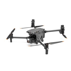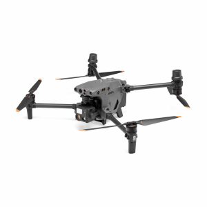
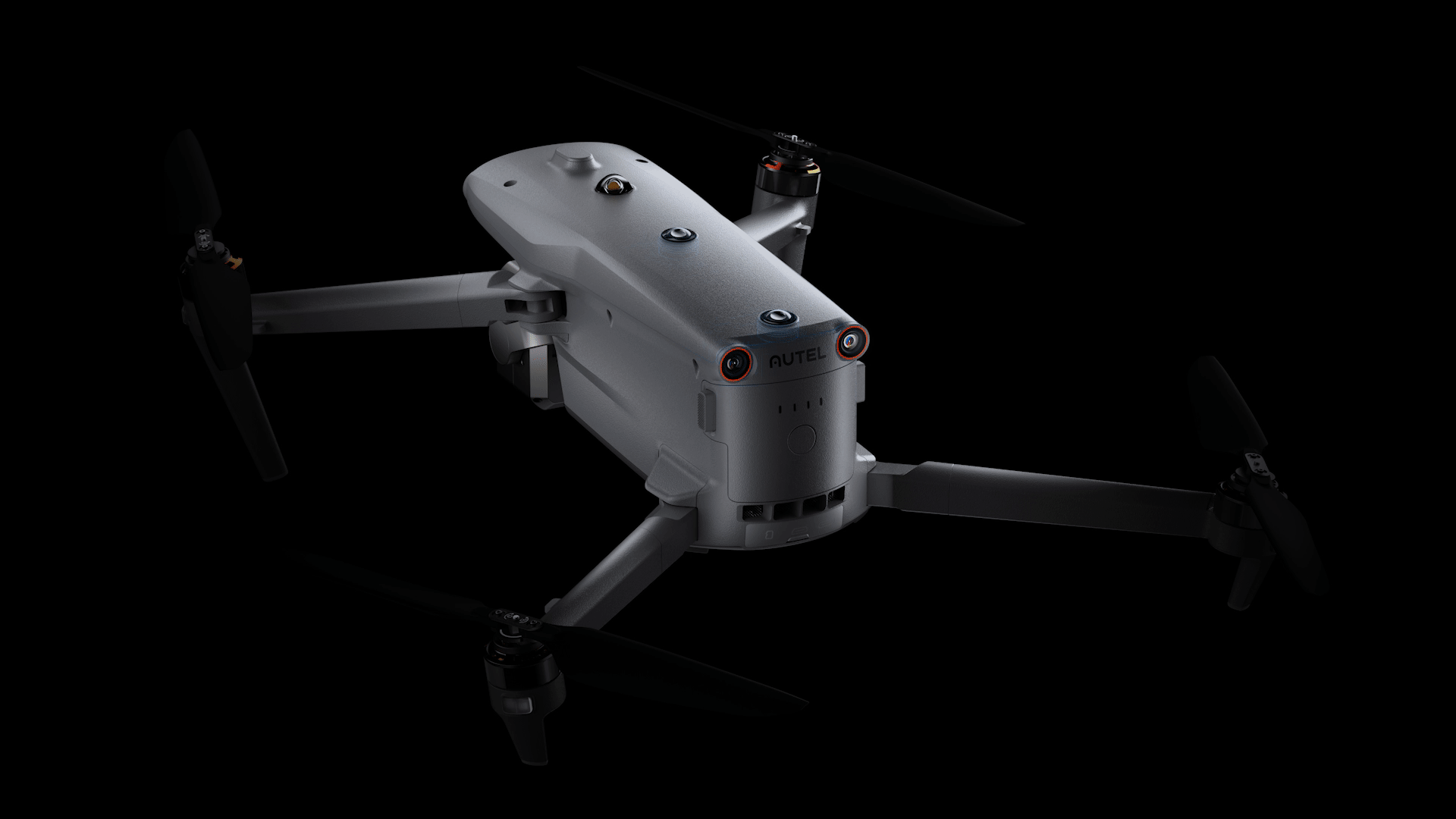
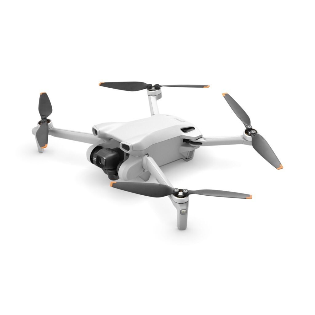
Дрон Autel Robotics EVO MAX 4N
- “N”–Explore the Night–Starlight Camera
- EU C2 Class Certificate
- A Leader of Drone Intelligence
- A-Mesh 1.0 – The Drone Industry’s First Mesh Networking Technology
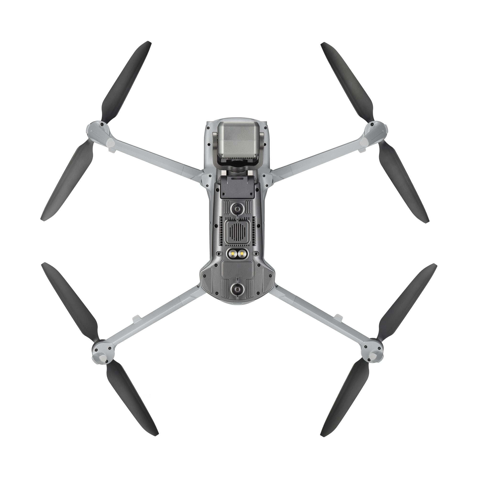
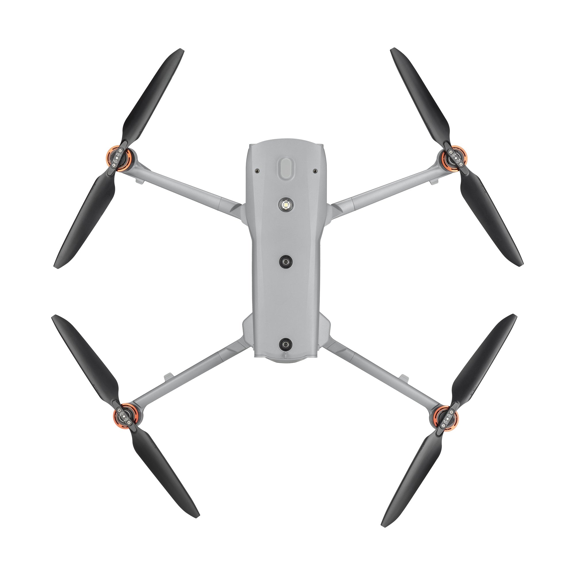
- No Blind Spots-Ultimate Obstacle Avoidance
- Anti Jam-Anti Interference
- 42 mins Max. Flight Time/27 mph* Max. Wind Resistance
- Autel SkyLink 3.0
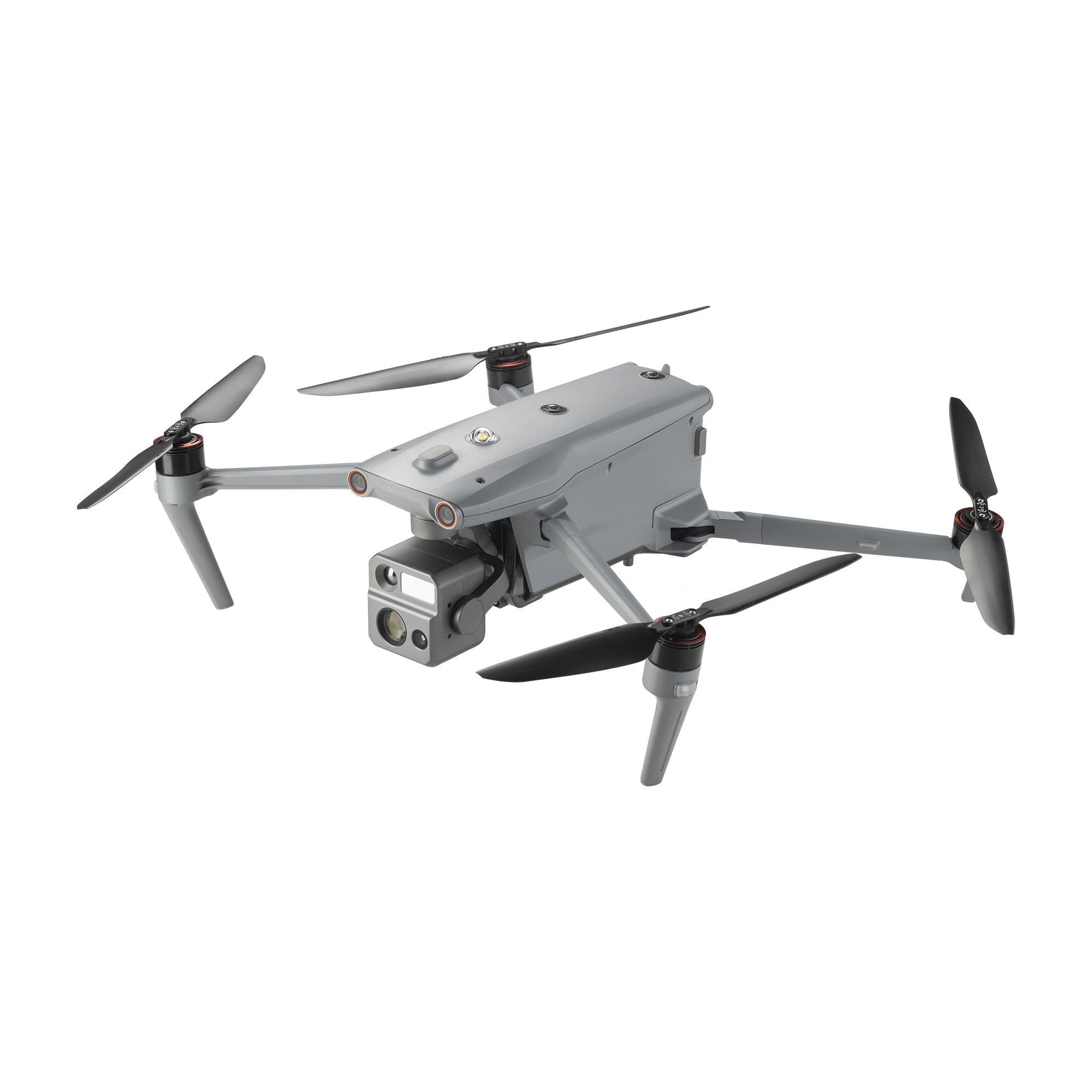
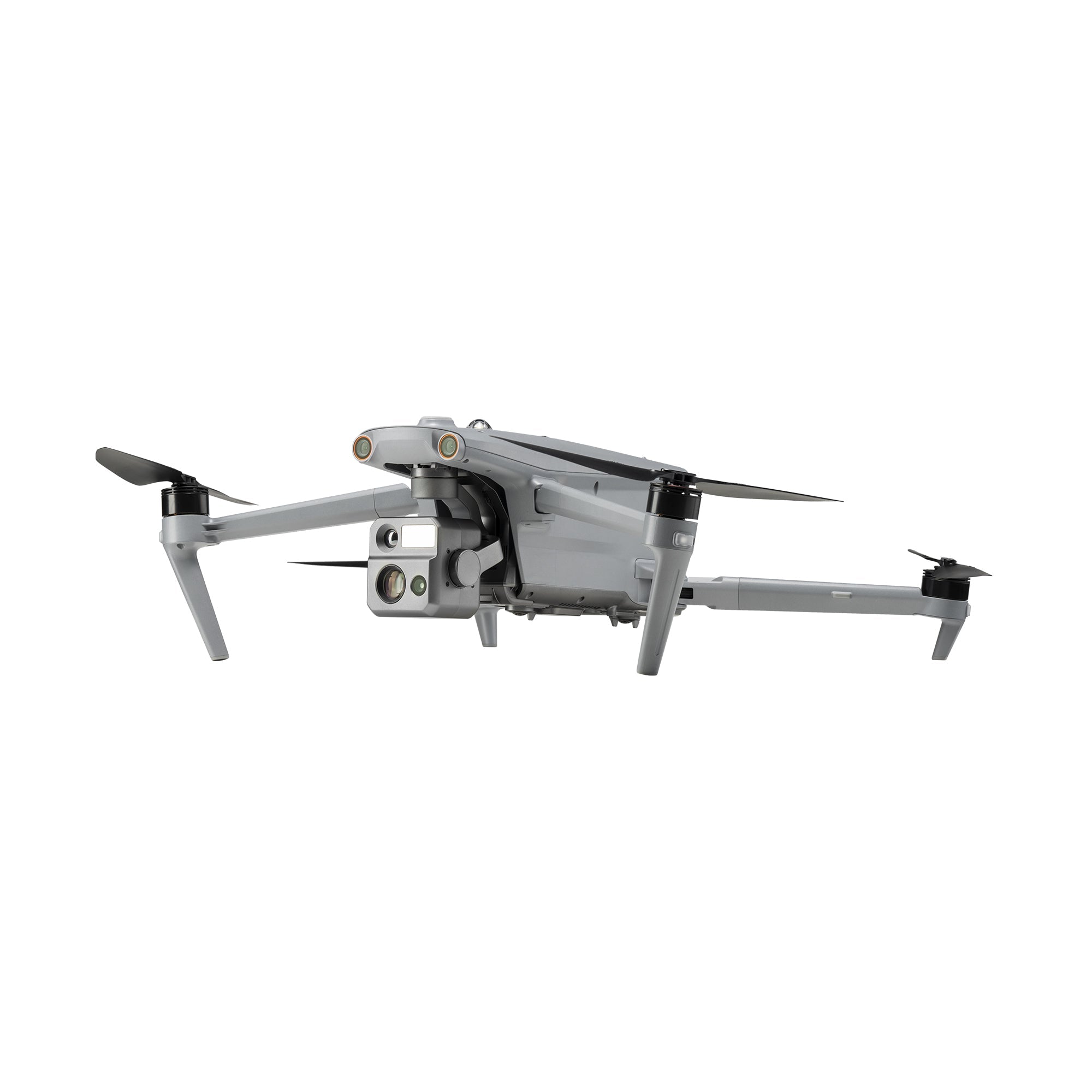
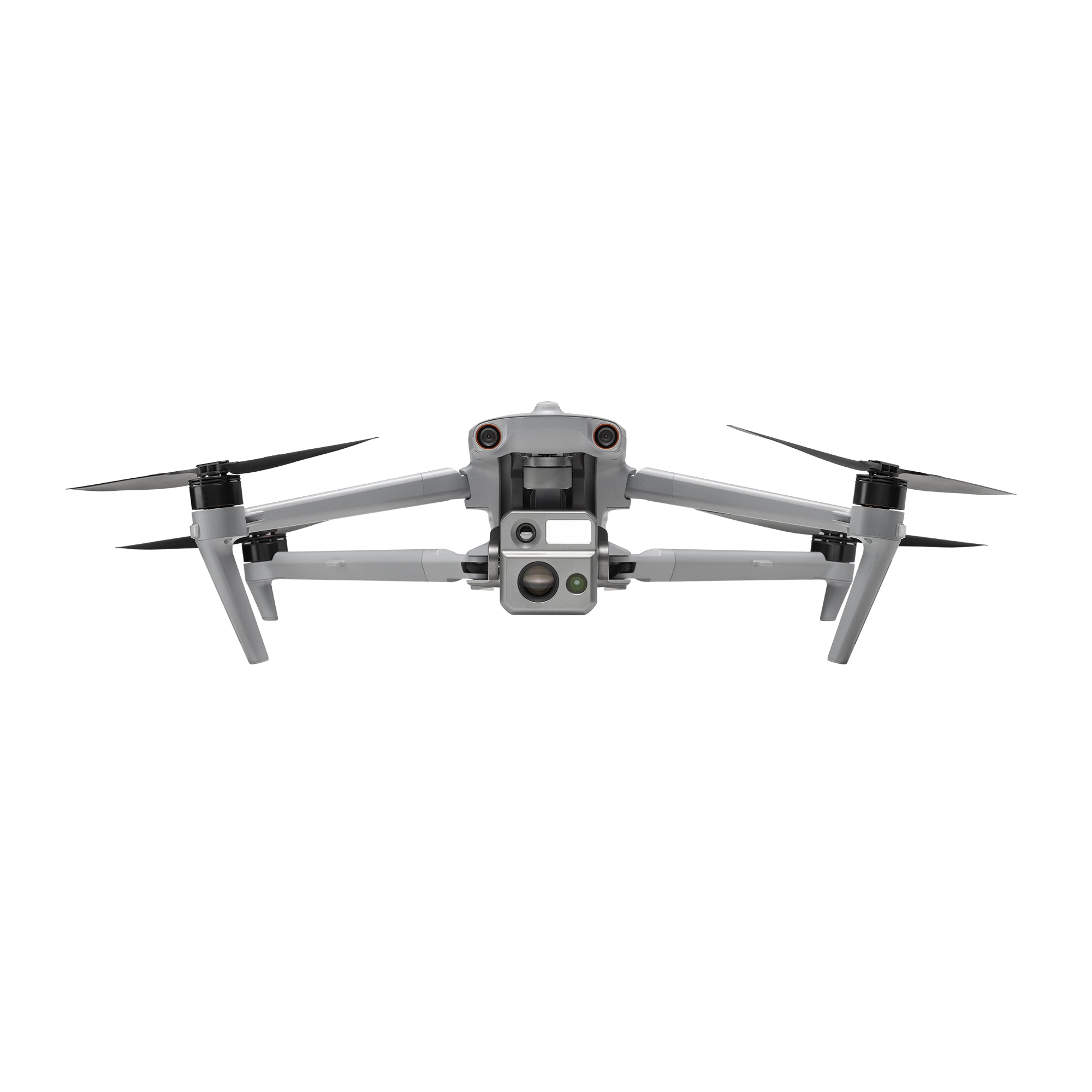
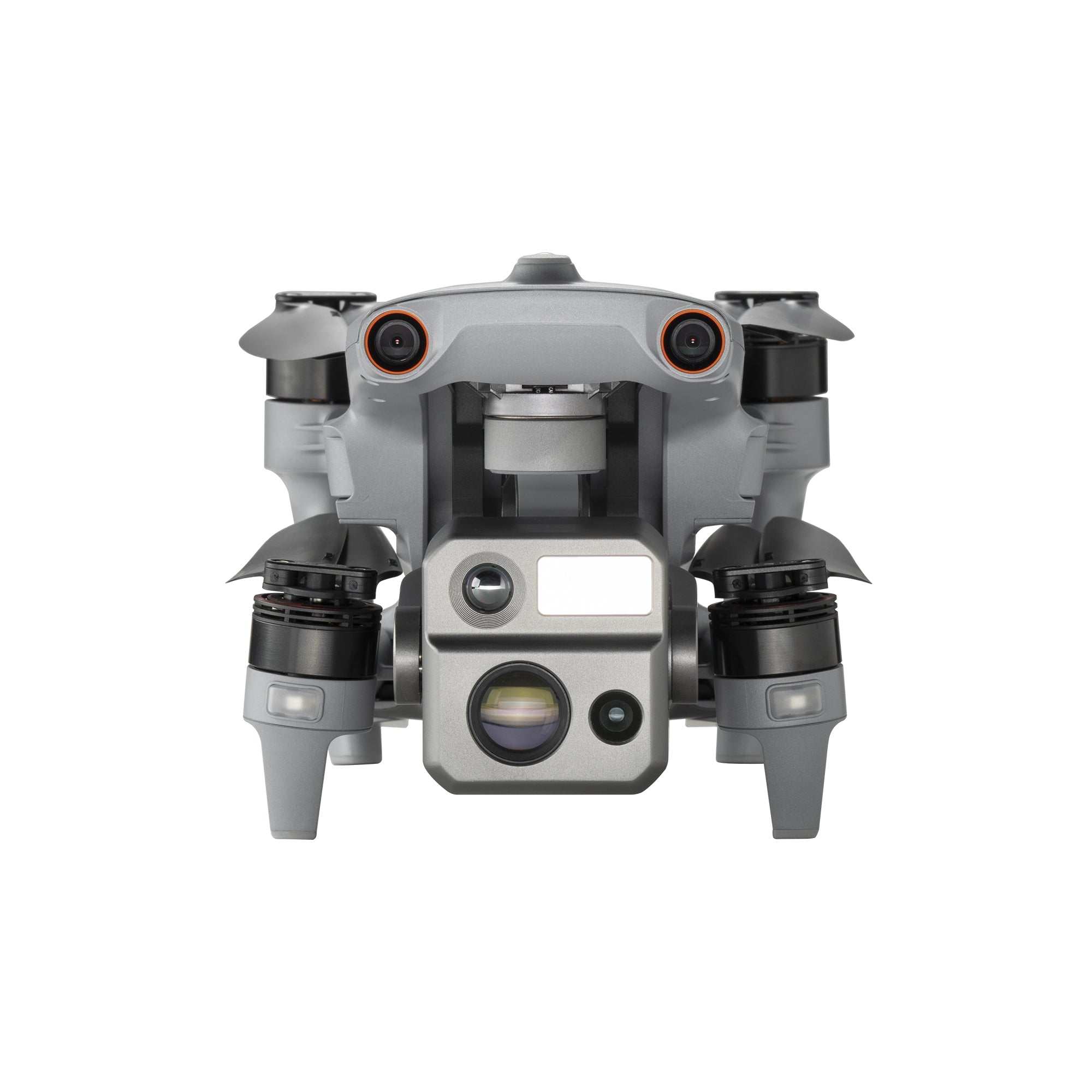
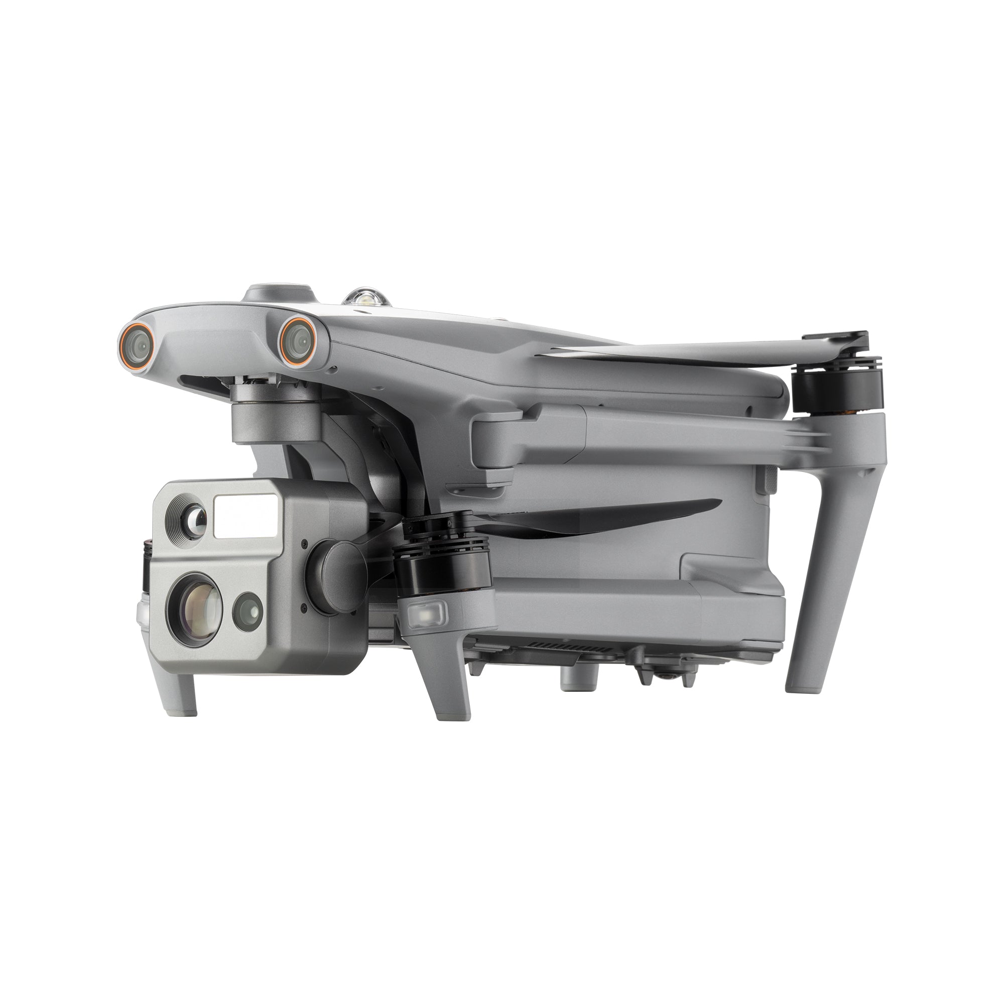
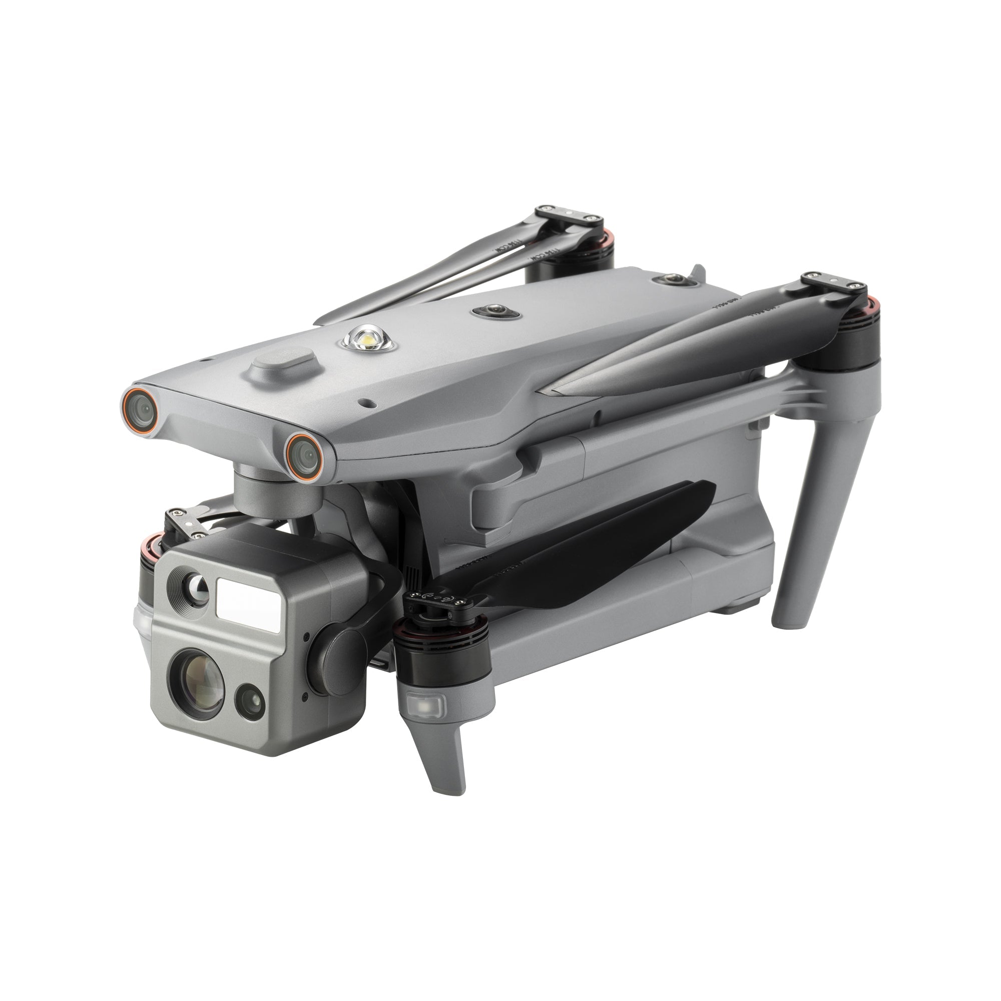
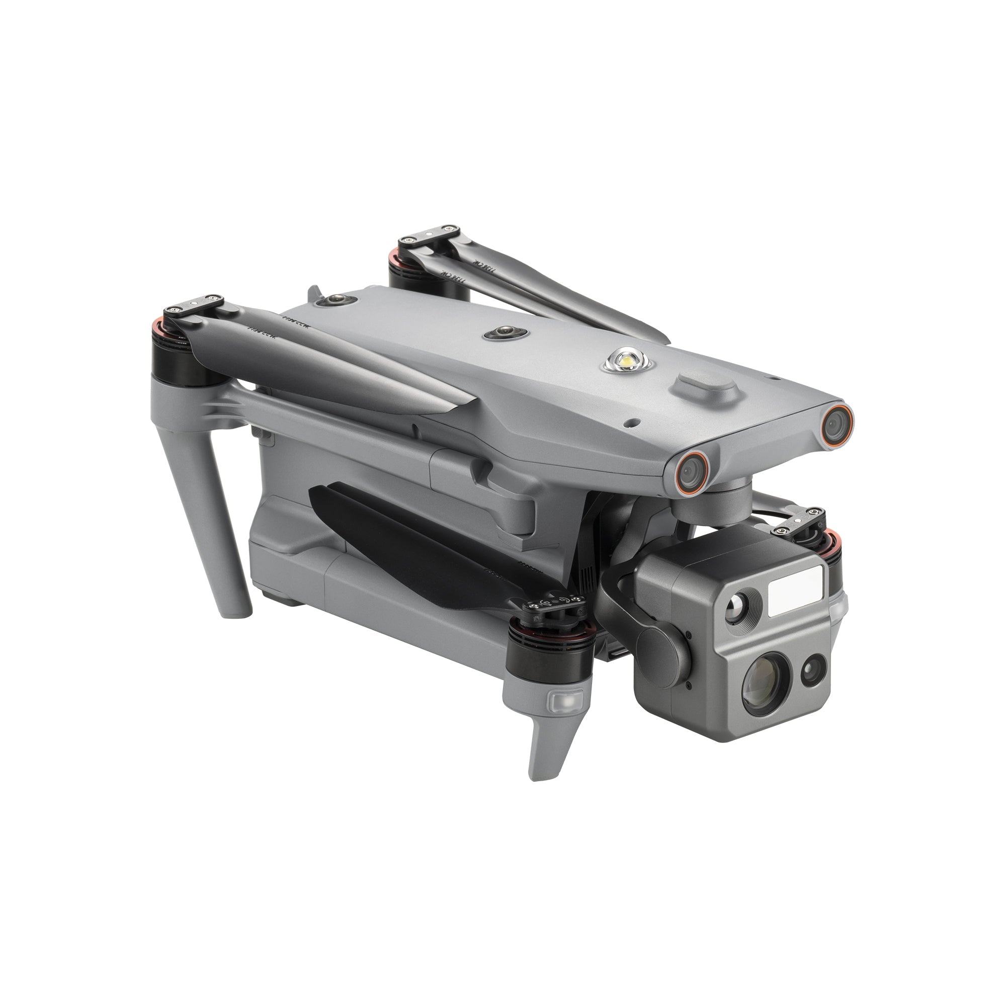
- Payload:Starlight Camera/ 50MP Wide Camera/640×512 Thermal Camera/Laser Rangefinder
- Smart Features: 3D Map Planning/Quick Mission/Mission Reproduction
Опис
Autel EVO MAX 4N
 EVO MAX 4N –A Leader of Drone Intelligence
 EVO MAX 4N –A Leader of Drone Intelligence
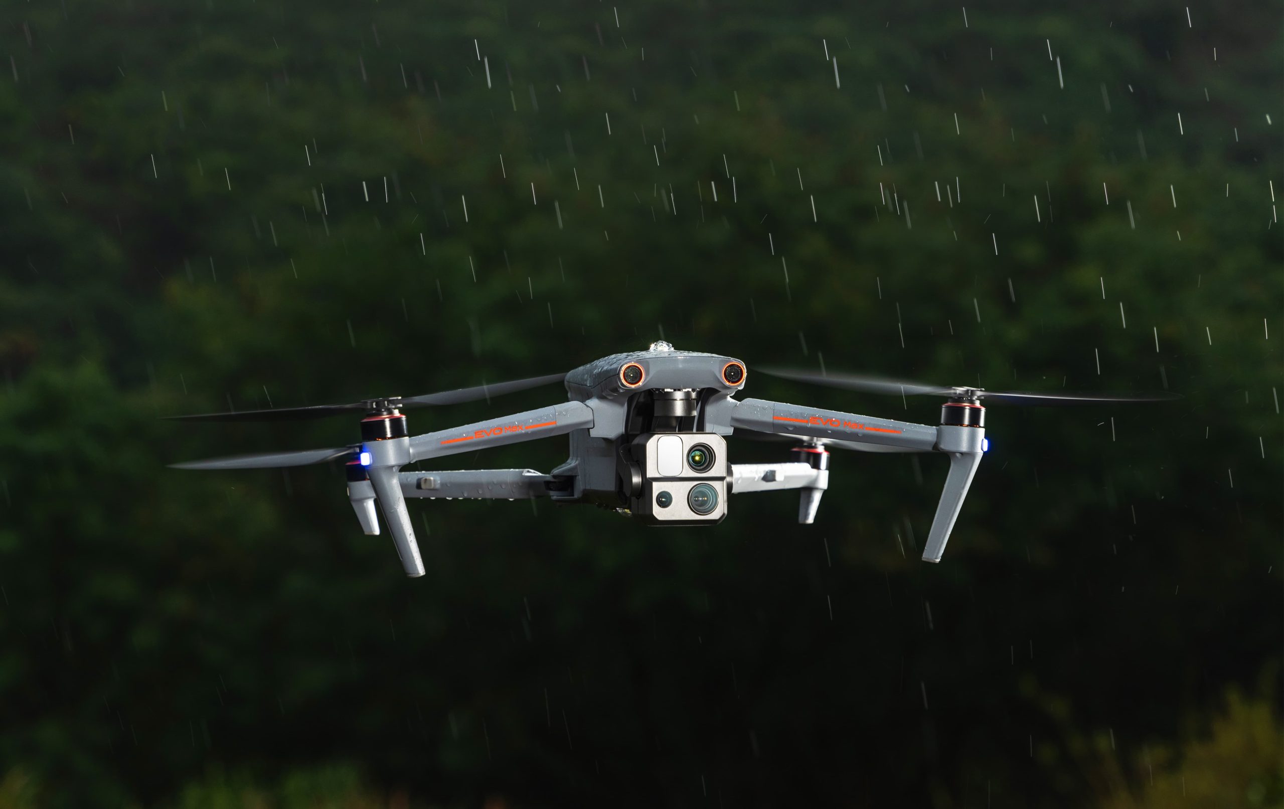
The EVO Max 4N brings powerful technologies and advanced autonomy to users. EVO Max 4N assesses complex environments to create real-time 3D flight paths for unparalleled obstacle avoidance.Advanced sensors make flight in GPS unavailable areas possible and the incredible new thermal payload unlocks new object identification and tracking scenarios.With a foldable, weather-resistant design, the EVO Max 4N is as portable as it is capable.
Autonomous Path Finding:Autel’s Autonomy Engine collects surrounding environmental data and plans 3D flight paths through complex environments such as mountains, forests, and buildings. Use cases include rapid 3D scene reconstruction, public safety overwatch, industrial inspection, and land surveying.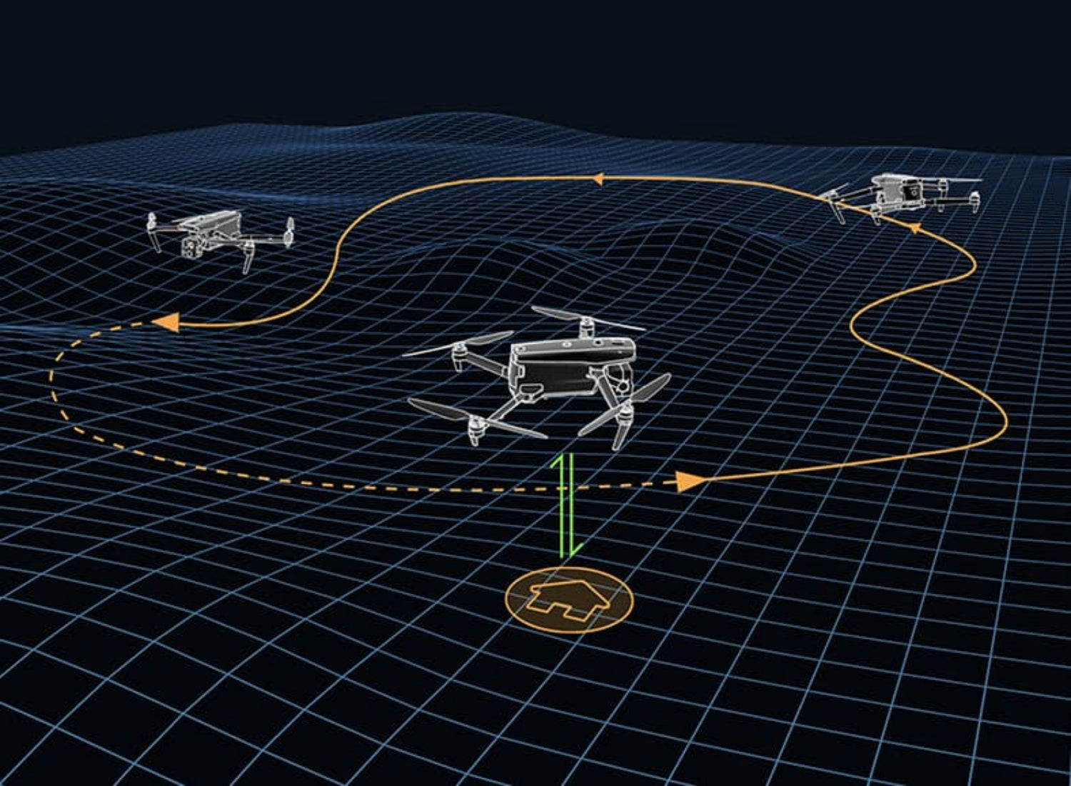
Navigation in GPS Denied Environment: Advanced sensors allow the EVO Max 4N to navigate within hardened structures, underground, or in environments without GPS.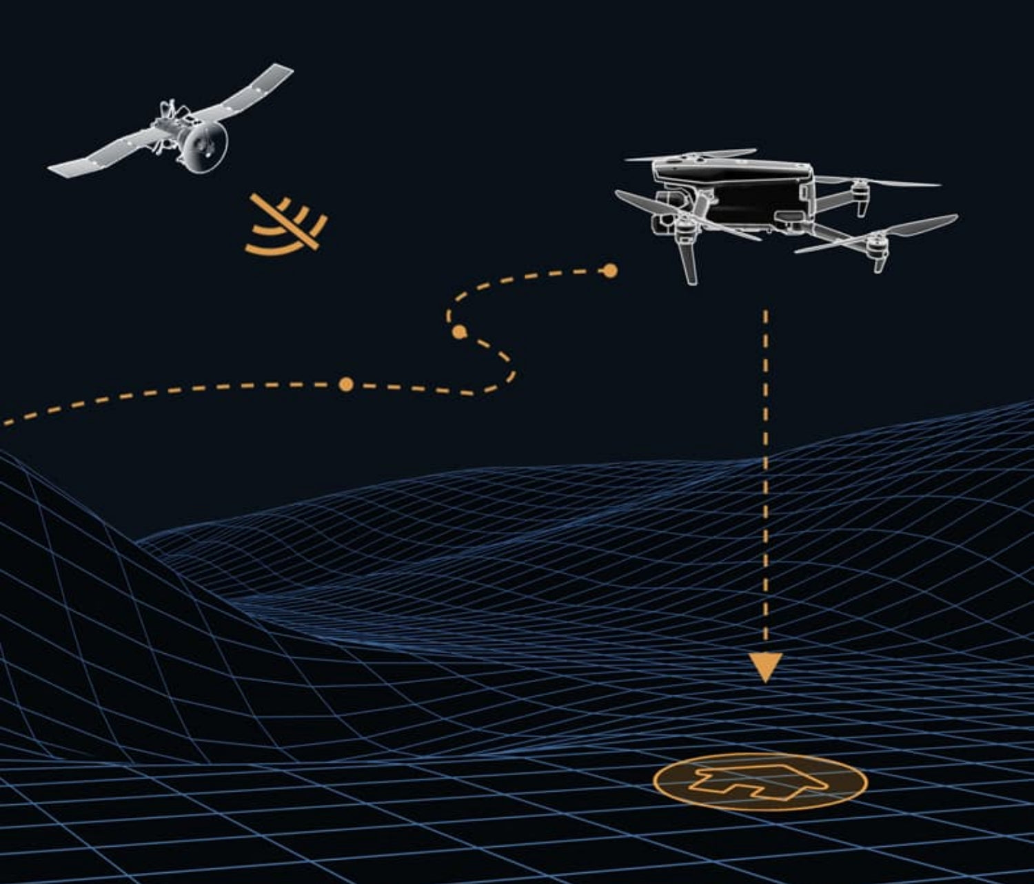
Accurate Object Identification and Tracking : Based on Autel’s AI recognition technology, the EVO Max 4N can automatically identify and lock onto different types of targets such as heat sources, moving people, or vehicles and achieve high-altitude tracking and data collection for law enforcement.![]()
No Blind Spots-Ultimate Obstacle Avoidance
EVO Max 4N is the only commercial drone that combines traditional binocular vision systems with millimeter wave radar technology. This allows the EVO Max 4N’s onboard Autel Autonomy Engine to perceive objects down to 0.5 inch, eliminating blind spots and enabling operation in low light or rainy conditions.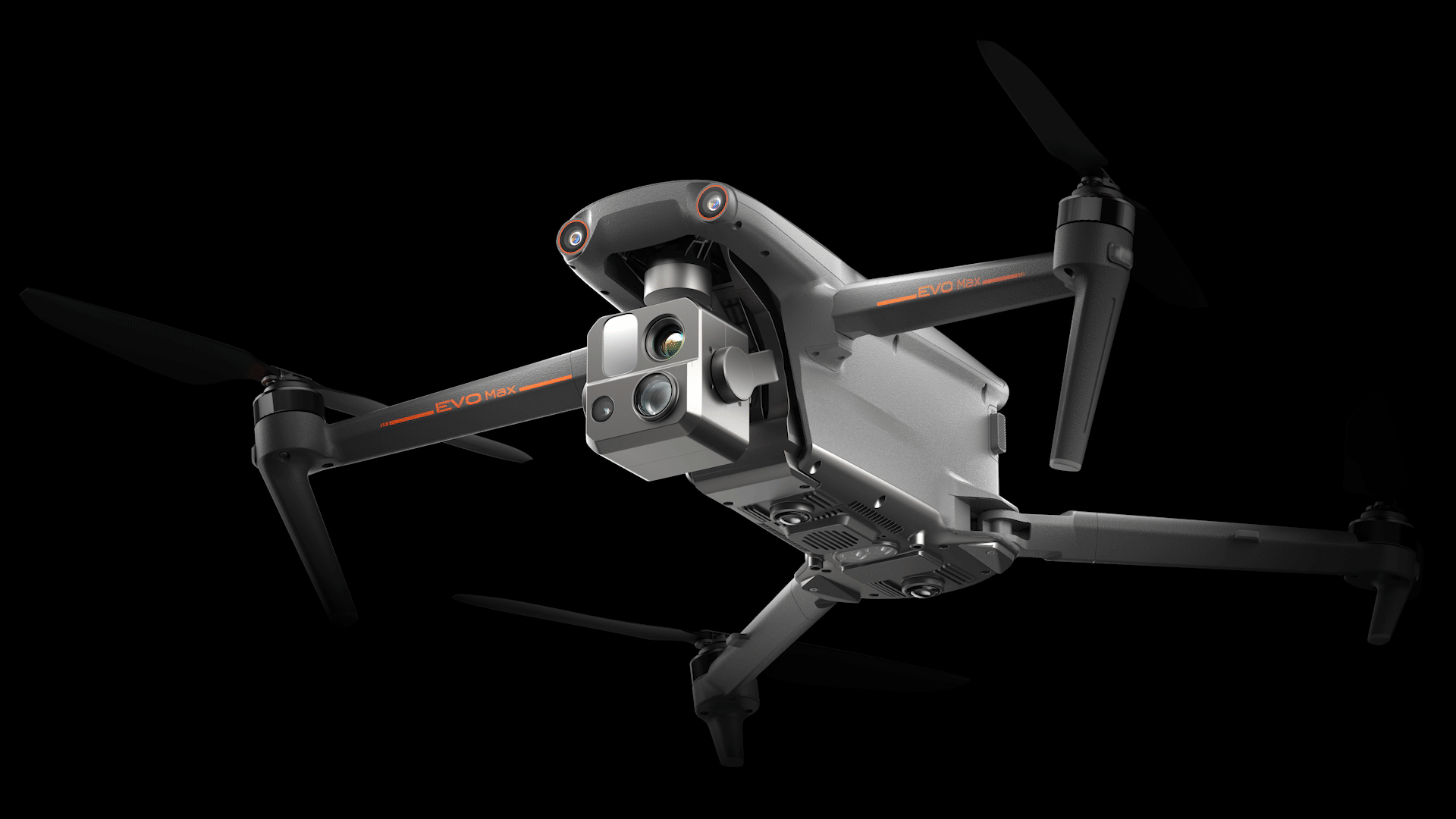
Anti Jam-Anti Interference
The EVO Max 4N uses advanced flight control modules and algorithms specially designed to counter RFI, EMI, and GPS spoofing. This enables the EVO Max 4N to fly confidently near power lines, critical structures, and in complex areas.
Weather Rating-IP43
A-Mesh 1.0 – The Drone Industry’s First Mesh Networking Technology
EVO Max 4N features the new A-Mesh system, enabling drone-to-drone autonomous communication, connection, and collaboration.
Strong Anti-Interference: The EVO Max 4N can communicate seamlessly with other drones in the vicinity, unlike a traditional chain structure. If a single drone fails or exits unexpectedly, the entire system will independently self-organize and continue to relay critical information.
Beyond-Line-of-Sight Applications: With A-Mesh, multiple aircrafts in the vicinity can act as relay points to greatly improve BVLOS operation effectiveness
Full-Fleet Control:Multiple drones can be controlled autonomously by 1 pilot or by a group of pilots simultaneously with or without LTE coverage.
Enhanced Range: Communication nodes can be placed statically on hills or poles to provide full coverage to an area, or a swarm of drones can provide mobile communication points to extend the coverage of the entire group.
Autel SkyLink 3.0
The EVO Max 4N SkyLink 3.0 system comes with 6 antennas, 4 frequency bands, AES-256 encryption*, and optional 4G integration* to provide users with the most advanced flight capabilities ever in an EVO.
12.4 miles: Image Transmission Distance 1080p/60fps: Real-Time Image Quality
900MHz/2.4GHz/5.2GHz/5.8GHz** : Frequency Bands <150ms Затримка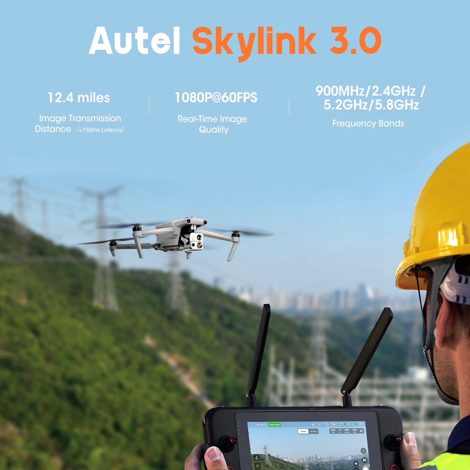
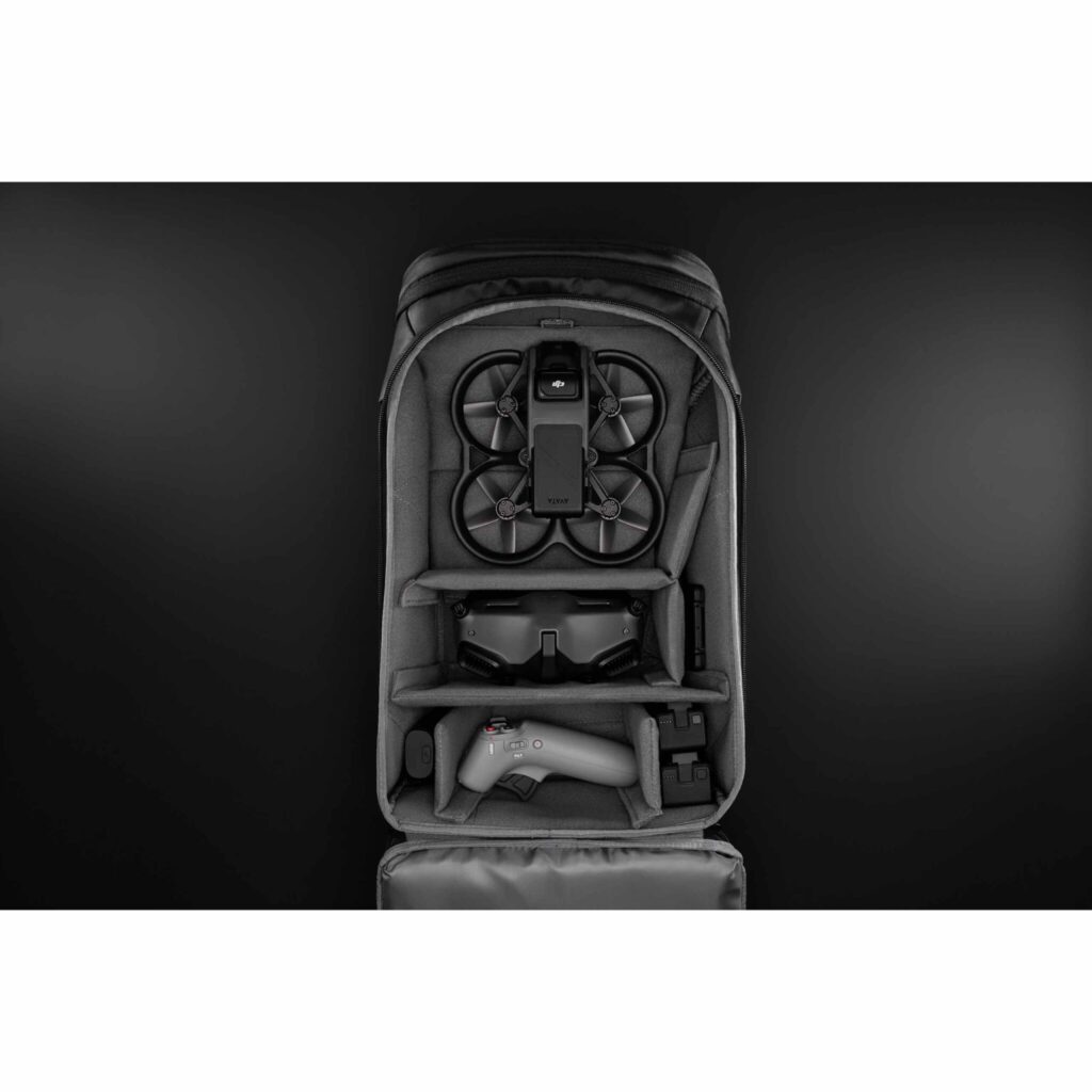
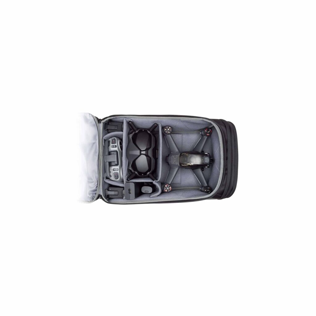
Mission Ready Payload
The payload integrates starlight camera,wide-angle camera, thermal camera and a laser rangefinder for all data capture needs and critical decision making.
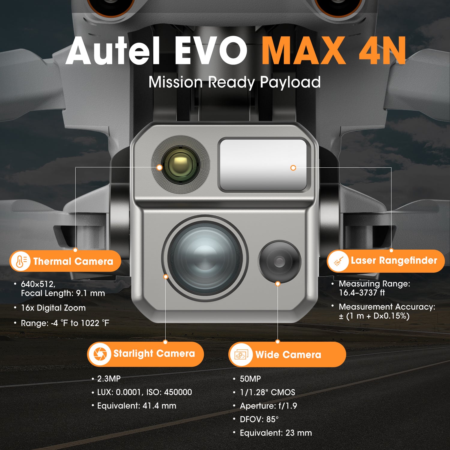
Starlight Camera: Explore the Night, 2.3MP
LUX: 0.0001, ISO: 450000
Equivalent: 41.4 mm
Wide Camera: 50MP 1/1.28″ CMOS Aperture: f/1.9 DFVO: 85° Equivalent: 23 mm
Thermal Camera: 640×512 Aperture: 13mm 16x Digital Zoom
Temperature Measurement Range: -20°C to 550°C
Laser Rangefinder: Measuring Range: 5 – 1200m
Measurement Accuracy: +1m
Autel Enterprise App Platform
The Autel Enterprise App is built from the ground up for industrial applications and features a brand-new interface for simple, efficient operation. Additional features and semi-autonomous modes maximize the EVO Max 4N’s mission capability.

Smart Features
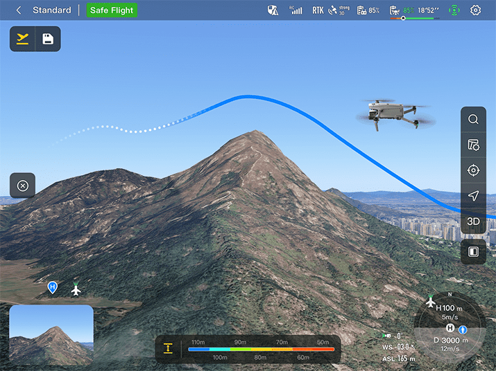
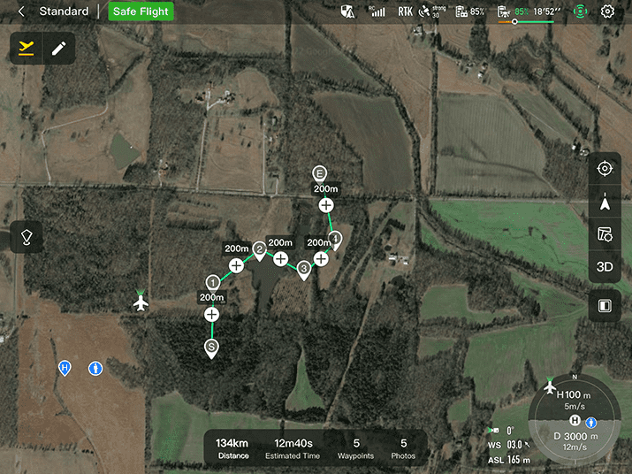
3D Map Planning: Plan, create, and execute 3D waypoint mission plan on a 3D map.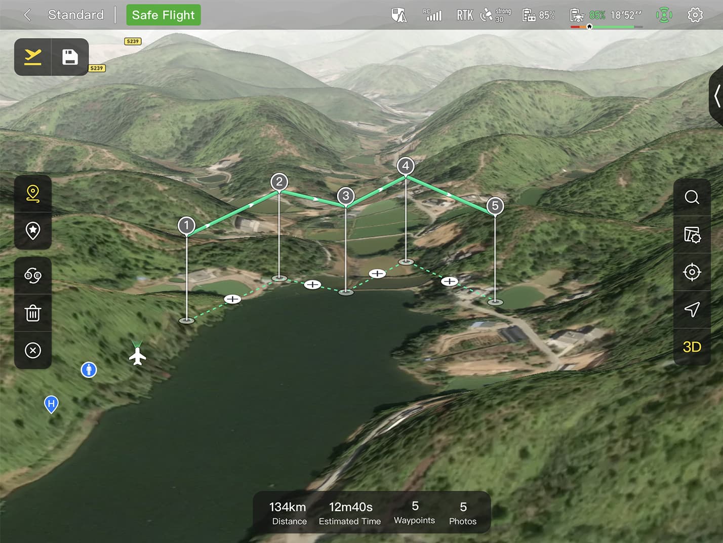
Quick Mission: Temporary quick missions can be created while executing other missions, and multiple sub-missions can be stacked for enhanced flexibility.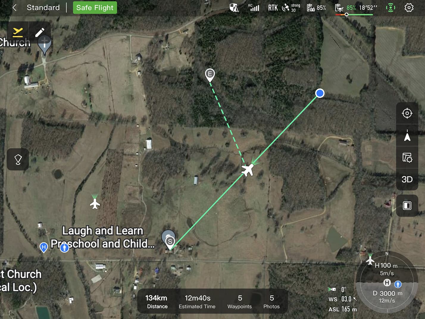
Mission Reproduction: With this feature activated, fly a manual or semi-autonomous mission, or string multiple missions together. The EVO Max4N will automatically record the camera angles and replicate the mission you just flew.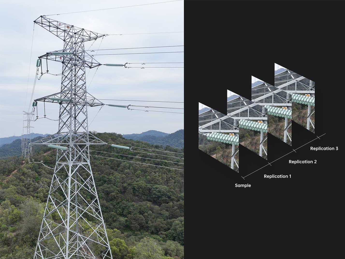
Multiple Mission Types
The Enterprise App provides various autonomous and semi autonomous mission planning for public safety, inspection, and surveying.
Terrain Follow: Maintain relatively constant altitude from the ground for uneven or sloped terrain.
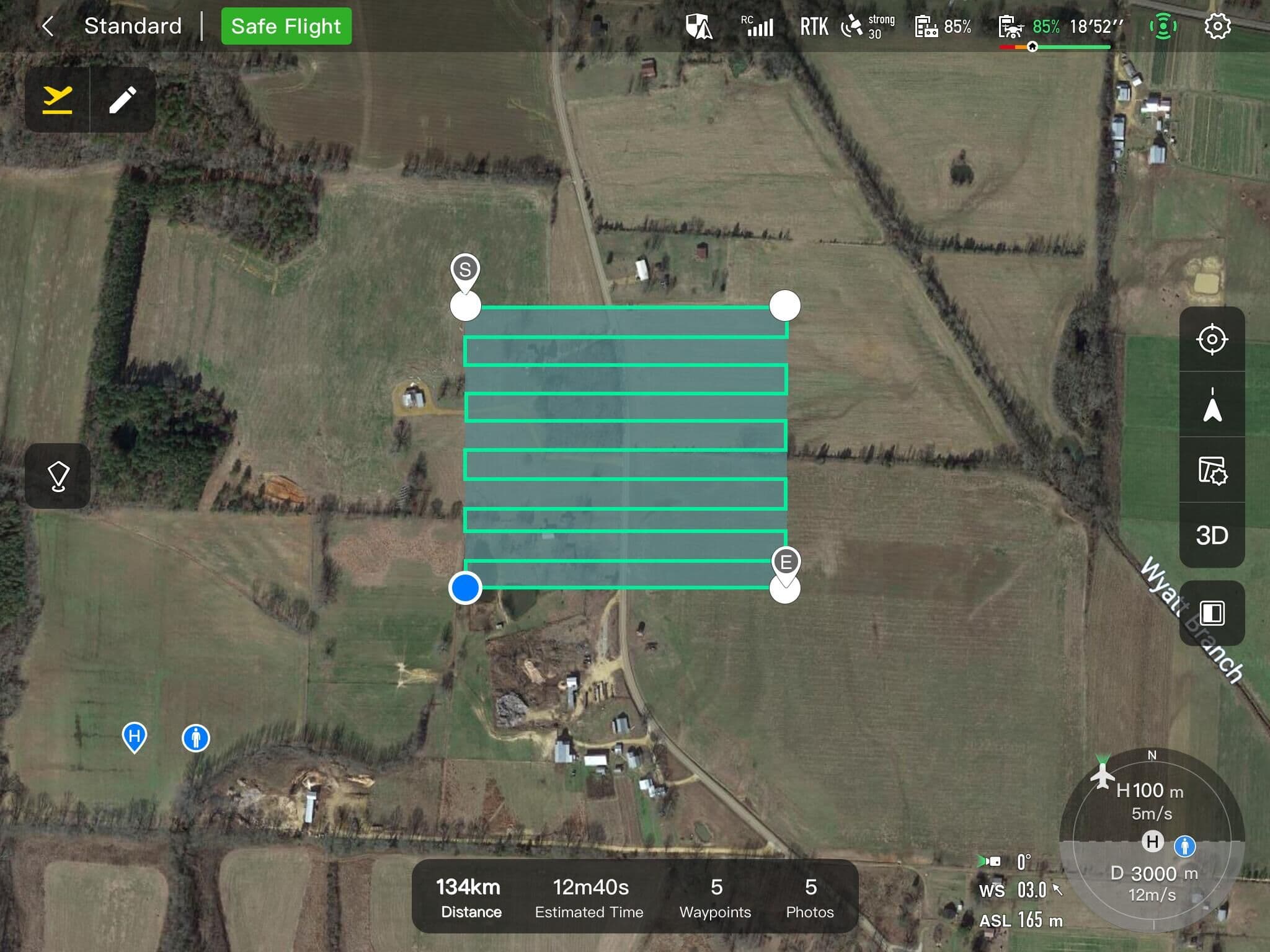
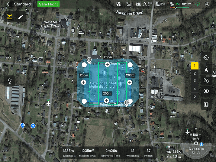
Rectangular Mission: One-click automatic generation of a rectangular flight area.
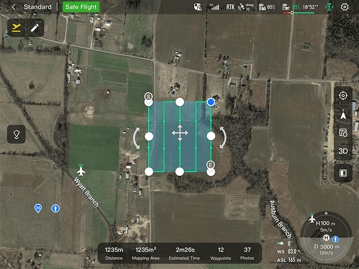
Automatic Mission Generation And Data Capture:Automatically produce routes by adding regional boundary points through dots or importing KML files. Waypoint Missions :Users can add waypointsfor flexible, non-structured flight paths.
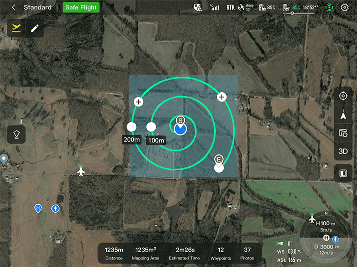
Oblique Photography:Automatically plan 5 groups of routes (1 ortho + 4 oblique) according to the flight area set by the user. Spiral Mission:Supports helical flight search in a designated area for SAR.
Vertical Scan:Perform vertical surveys for building facades, open pit walls, and towers. Corridor Mission:Supports intuitive and effective corridor mission planning for roads, rivers, pipelines, power lines and other narrow,large-scale terrain.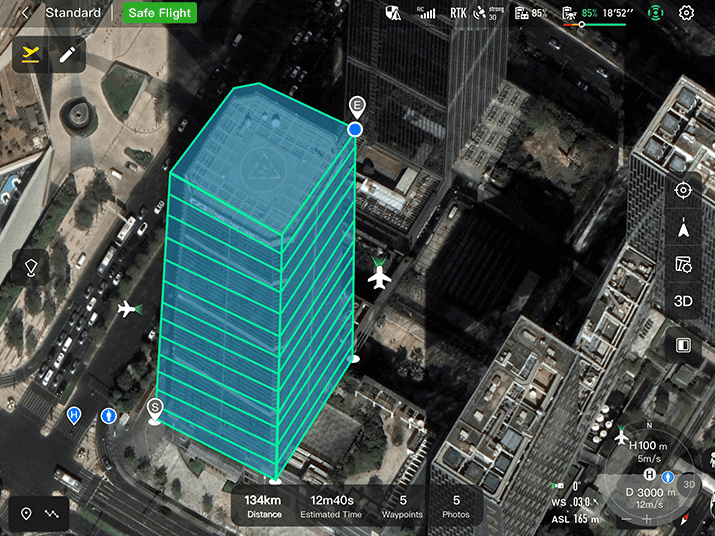

Data Security
Privacy Protection: Data involving user and aircraft information, including flight logs, locations,and account information can only be physically accessed via the aircraft locally.
Encrypted Data Storage: Supports AES-256 encryption for photos, videos, and flight logs, are password-protected.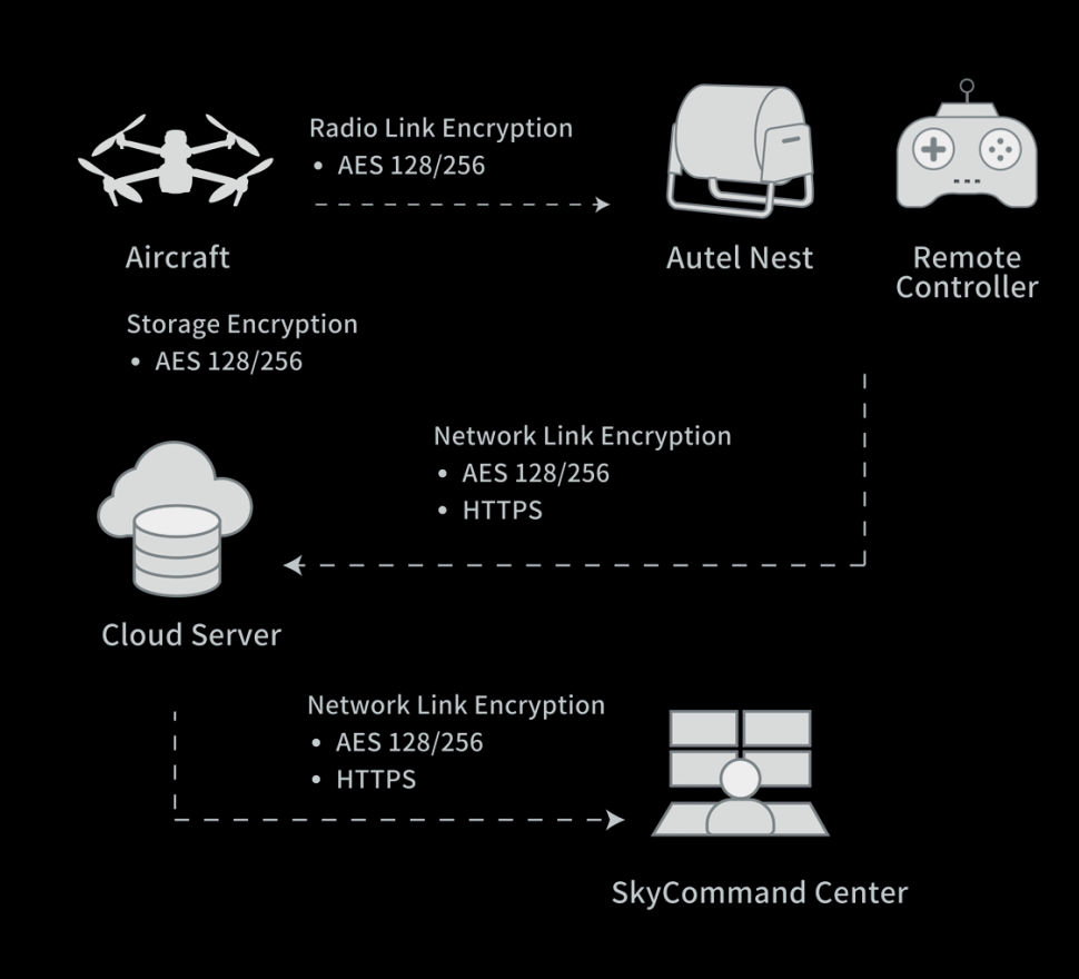
Enhanced Live-View
Multi-channel Projection Screen:Supports simultaneous output of RGB, infrared, night vision, and wide-angle images.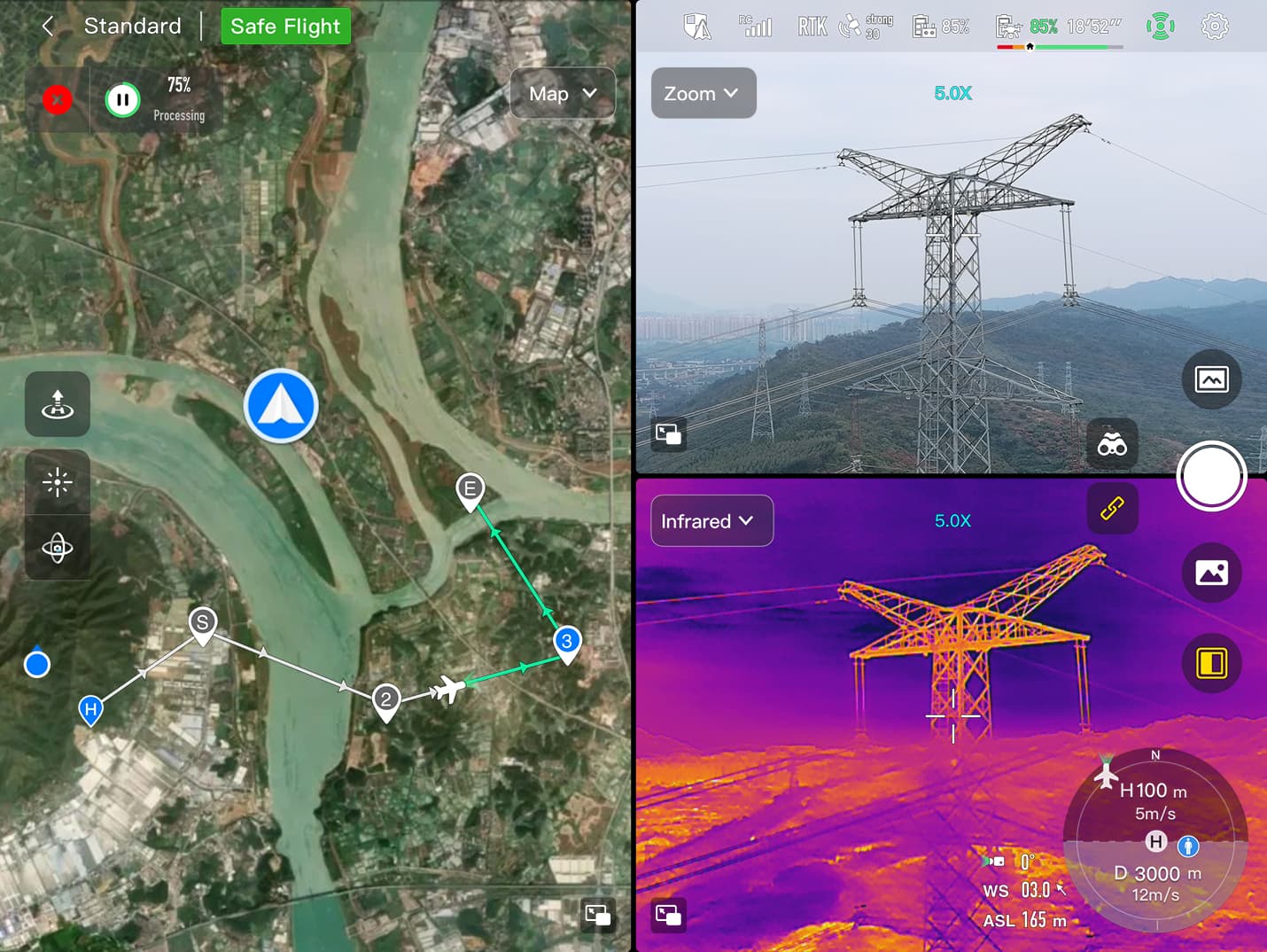
AR Scene:Geo-location data and other aircraft location info detected by ADS-B can overlay on real-time map, which is convenient for users to confirm the drone’s location and avoid airborne risks.
Autel SDK
The Autel SDK is open to the world, helping developers and partners reduce software and hardware development costs and jointly create a new industry ecosystem.(Note: Only mobile SDK is availbel at this moment,other 2 not released yet) 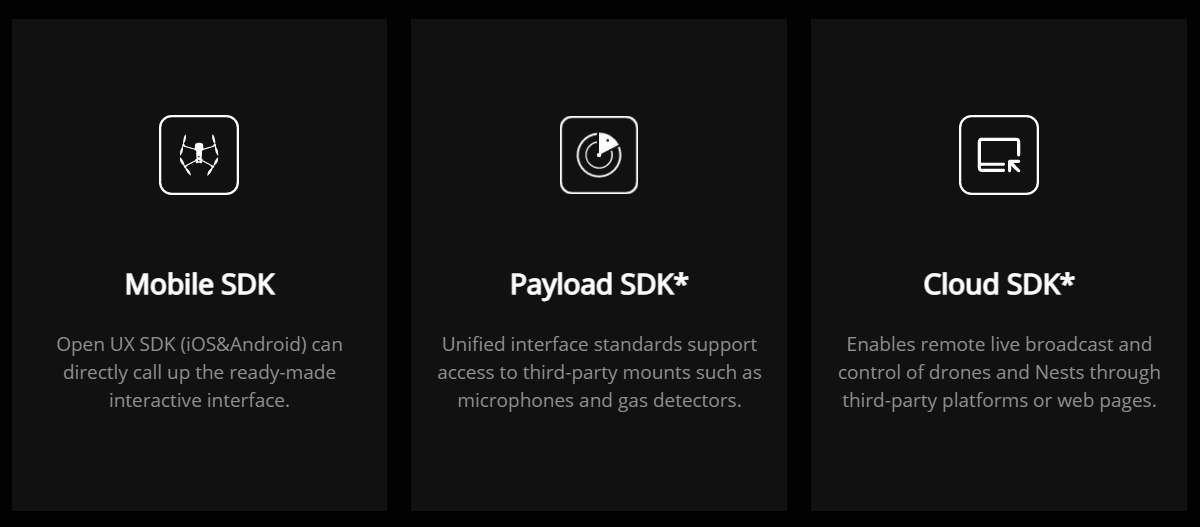
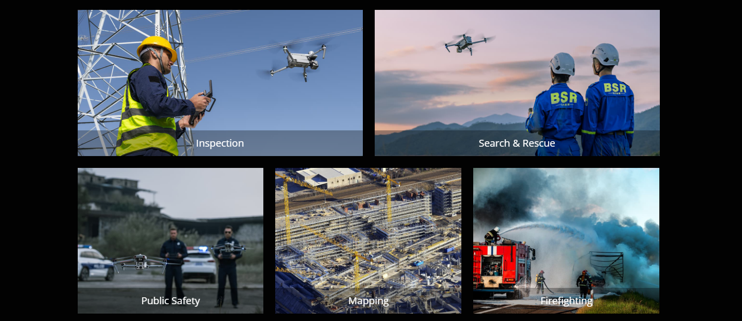
Widely Application
Autel Explorer


Додаткова інформація
| Max. Takeoff Weight | 4.41 lbs (1999 g) |
|---|---|
| Розміри | 576*660*149 mm (folded, incl. propellers)340*407*148 mm (folded, excl. propellers)257*136*133 mm (unfolded, excl. propellers) |
| Diagonal Wheelbase | 1.52 ft (464mm) |
| Максимальна швидкість підйому | 8m/s |
| Максимальна швидкість спуску | 6m/s |
| Max Horizontal Speed (windless near sea level) | 23m/s*Maximum speed in Ludicrous Mode is 19m/s when operating in EU regions. |
| Максимальна стеля обслуговування над рівнем моря | 23000ft (7000m) |
| Max Flight Time (windless) | 42 mins |
| Max Hovering Time (windless) | 38 mins |
| Max Wind Resistance | 27mph**Takeoff and landing can withstand wind speeds up to 27 mph (12 m/s). |
| Максимальний кут нахилу | 35° |
| Максимальна кутова швидкість | Pitch: 300°/s; Yaw: 120°/s |
| Hovering Accuracy | Vertical:±0.1 m (Vision System enabled);±0.3 m (GPS enabled);±0.15 m (RTK enabled);Horizontal:±0.15 m (Vision System enabled);±0.3 m (GPS enabled);±0.1 m (RTK enabled); |
| Механічний діапазон | Pan: -135° to 45°Tilt: -45° to 45°Roll: -45° to 45° |
| Контрольований діапазон | -90° to 30° |
| Стабільна система | 3-axis mechanical gimbal (pan, tilt, roll) |
| Max Control Speed (pitch) | 200º/s |
| Діапазон кутових коливань | <0.005° |
| Max Photo Size | 8000×6000 |
| Датчик | 1/1.28 CMOS, Effective pixels: 50M |
| Exposure Compensation | ±3EV 0.3EV/step |
| Діапазон ISO | Auto:Photo: ISO100~ISO6400Video: ISO100~ISO64000 (Night scene mode: up to ISO64000)Manual:Photo: ISO100~ISO12800Video: ISO100~ISO6400 |
| Витримка | Photo: 8s ~ 1/8000sVideo: 1s ~ 1/8000s |
| Max. Video Resolution | 3840×2160 |
| Thermal Imager | Uncooled VOx Microbolometer |
| Лінза | DFOV: 42° IFOV: 0.92mradAperture: 13mmFocus: f/1.2 |
| Infrared Temperature MeasurementAccuracy | 26.6~37.4 ℉ or reading ±3% (usingthe larger value) @ambienttemperature -4℉ to 140℉ |
| Роздільна здатність відео | 640*512 |
| Photo Size | 640*512 |
| крок пікселя | 12 um |
| Temperature Measurement Method | Center measurement, pot measurement, rectangular measurement |
| Temperature Measurement Range | -4℉ to 302℉, 32℉ to 1022℉ (-20°C to 150°C, 0 to 550°C) |
| Temperature Alert | High and low temperature alarm thresholds, reporting coordinates and temperature values |
| Measurement Accuracy | ±3.3ft (1m) |
| Measuring Range | 3937ft (1200m) |
| Max Transmission Distance(unobstructed, free of interference) | 12.4 miles/20km (FCC), 4.9 miles/8km (CE) |
| Independent Networking | Autel Smart Controller V3 |
| Non-GPS Hovering and Manual Flight | Indoor: Horizontal error ≤1.18in (At least have texture at one direction)Outdoor:Daytime: Within 1640ft (500m) flight height, horizontal error < 0.01*heightNight: Manual flight is controllable within 328ft (100m) flight height |
| Non-GPS Return-to-Home | Within 1640ft (500m) flight height, horizontal error of Return-to-Home point < 11.81in |
| Automatic Obstacle Rerouting | High Speed Obstacle Rerouting: Flight speed up to 45mph (20m/s) when Min. safety distance to obstacle is 4.9ft (1.5m)High Precision Obstacle Rerouting: Flight speed could reach 6.7mph (3m/s) when Min. safety distance to obstacle is 1.64ft (0.5m) |
| Multi-target Recognition and Tracking | Target identification types: people, vehicles, boatsNumber of targets detected: 64Comprehensive recognition accuracy: > 85% |
| Frequency | 60Ghz~64Ghz**Please fly safely and consult your local laws and regulations. |
| Size | 1.5*0.55*0.08 in (38*14*2mm) (L*W*H) |
| Вага | 0.07oz (2g) |
| EIRP | 18dBm |
| Sensing Range | Upward: 5.9~787.4in (0.15~20m)Downward: 3.9~4724.4in(0.1~120m)Forward and Backward (Standard/Comfortable): 0.82~98.43ft (0.25~30m) Forward and Backward(Ludicrous): 1.64~196.85ft (0.5~60m) |
| Speed Measurement Range | ± 134mph (60m/s) |
| Speed Measurement Accuracy | ≤1% |
| Max. Target Detection Number | 32 |
| Obstacle Sensing Range | Forward/Upward/Downward/Backward/Sideward: 0.2~50m |
| Поле зору | Forward/Backward/Sideward: 60°(H),80°(V)Upward/Downward: 360°(H),190°(V) |
| Screen | 7.9 inch, 2000nits max. brightness, 2048*1536 resolution |
| External Battery | Capacity: 5800mAhVoltage: 11.55VBattery Type: Li-onEnergy: 67WhCharing time: 120minsIntelligent Lithium Ion Battery |
| Час роботи | 3 hours (Max. brightness)4.5 hours (50% brightness) |
| Max Transmission Distance(with interference) | 12.4 miles/20km (FCC), 4.9 miles/8km (CE) |
| IP Rating | IP43 |
| Storage | 128G |
| ГНСС | GPS+GLONASS+Galileo+Beidou+NavIC+QZSS |
| Робоча температура | -4°F to 104°F (-20℃ to 40℃) |
| Протокол Wi-Fi | WiFi Direct, Wi-Fi Display,802.11a/b/g/n/acSupport 2 x 2 MIMO Wi-Fi |
| Робоча частота | 2.400 – 2.4835 GHz;5.150 – 5.250GHz;5.725 ‒ 5.850 GHz |
| Потужність передавача (ЕІРП) | 2.400 – 2.4835 GHzFCC/CE:≤20dBm5.150 – 5.250GHzFCC:≤17dBm5.725 ‒ 5.850 GHzFCC:≤17dBmCE:≤14dBm |
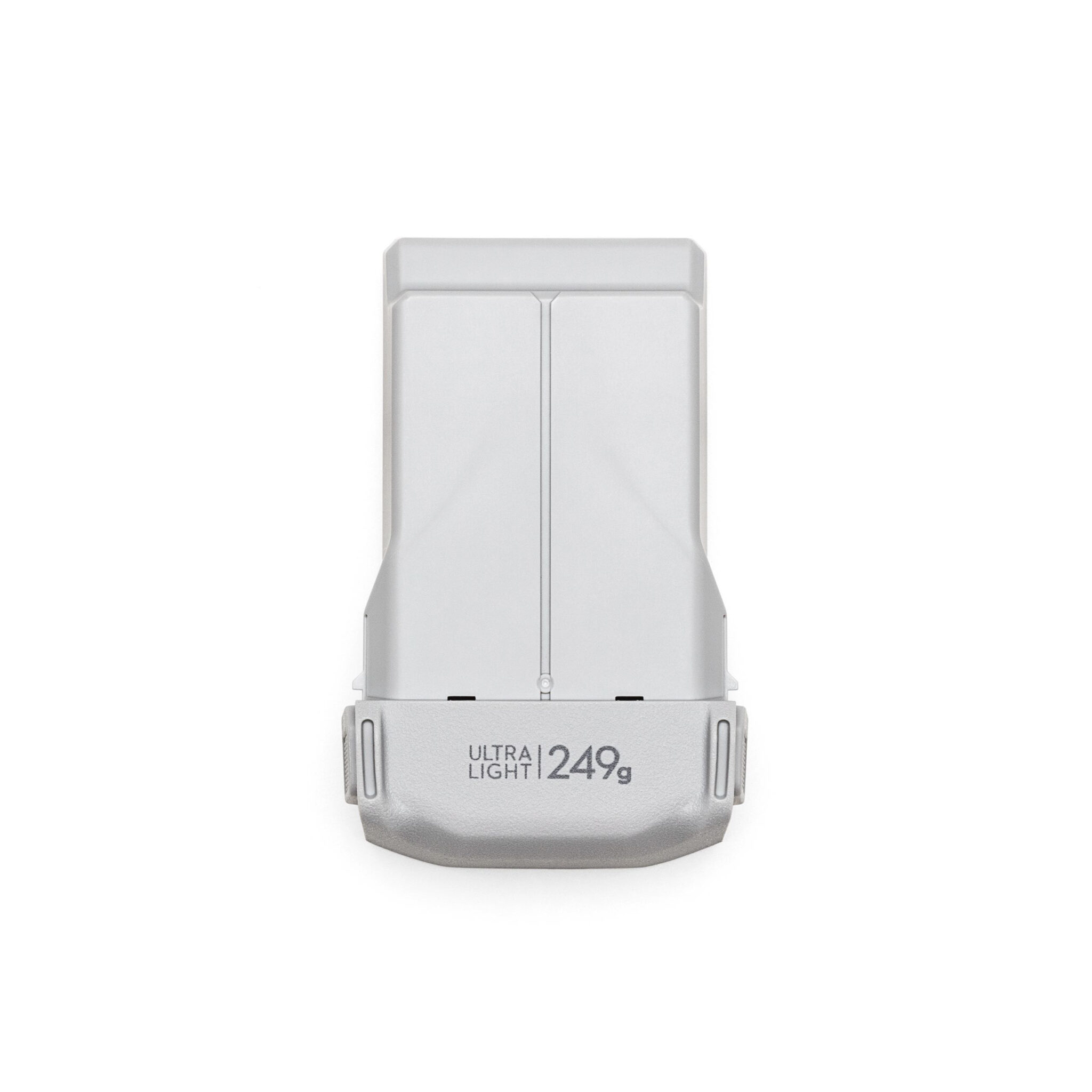
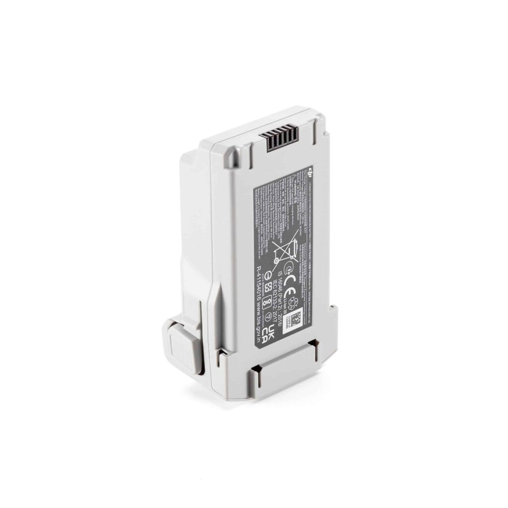
| Місткість | 8070mAh |
| Напруга | 14.88V |
| Тип батареї | LiPo 4S |
| Енергія | 120wh |
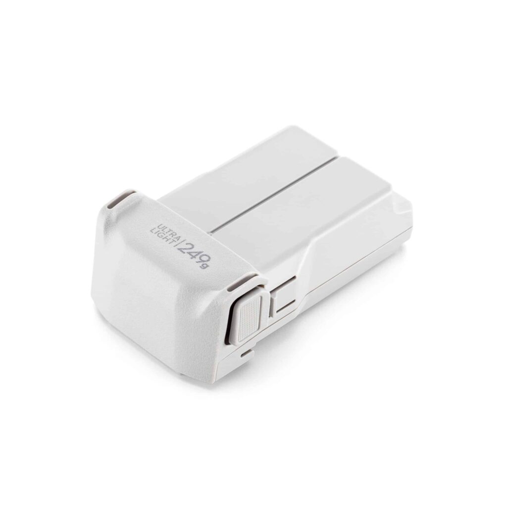
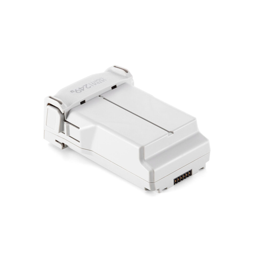
| Net Weight | 1.15 lbs (520g) |
| Температура заряджання | 41° F to 113° F (5ºC to 45ºC) When the temperature is lower than 10° C (50° F), the selfheating function will be automatically enabled. Charging ina low temperature may shorten the lifetime of the battery. |
| Hot Swap | Support |
Супутні товари

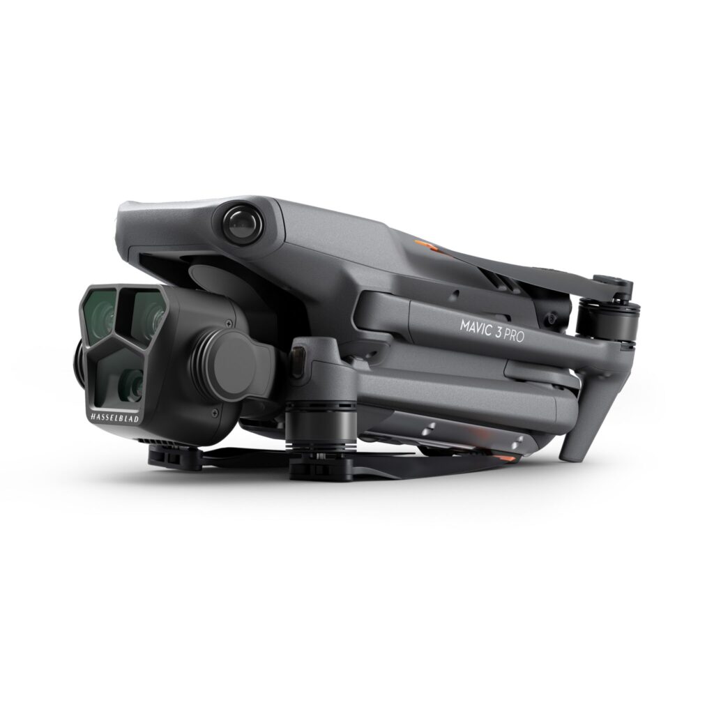
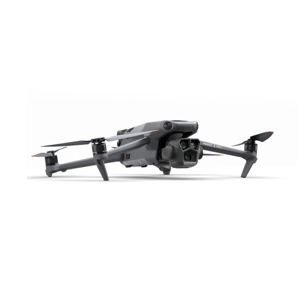
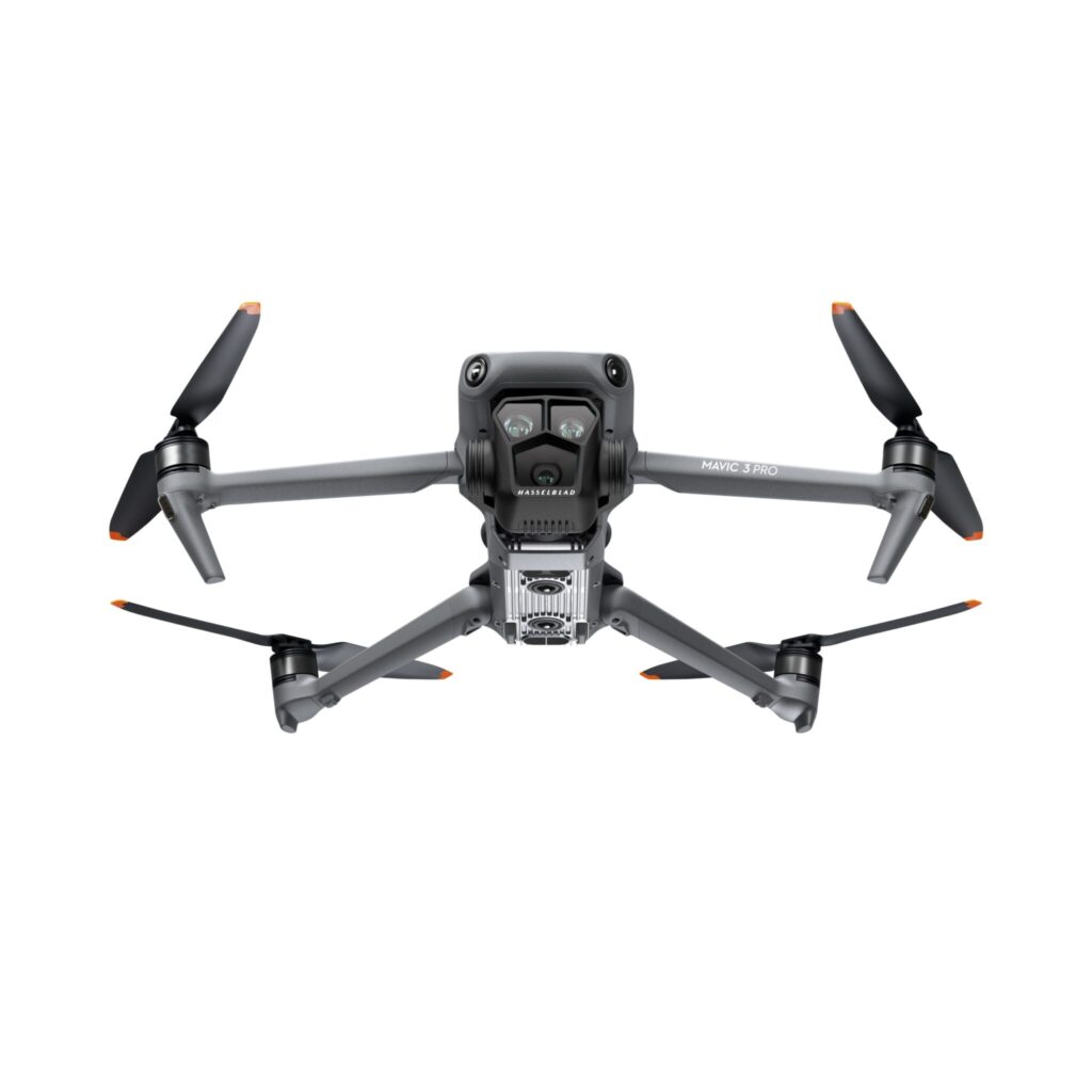
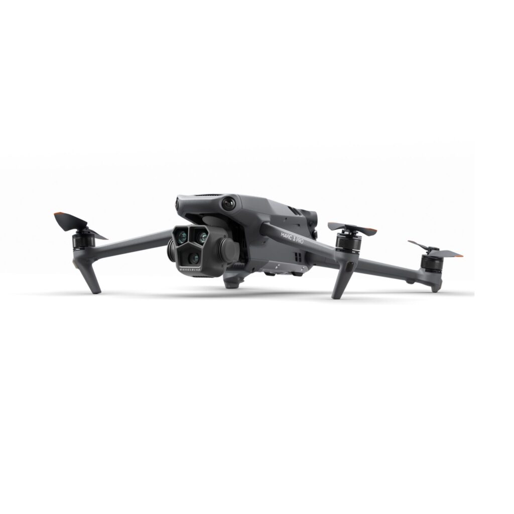
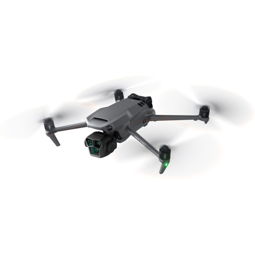
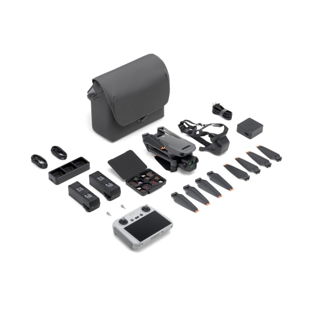
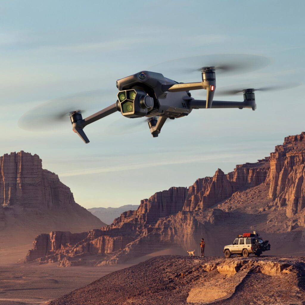
DJI Mavic 3 Pro Fly More Combo (DJI RC)
Початкова ціна була: 2 799,00 €.2 649,00 €Поточна ціна: 2 649,00 €.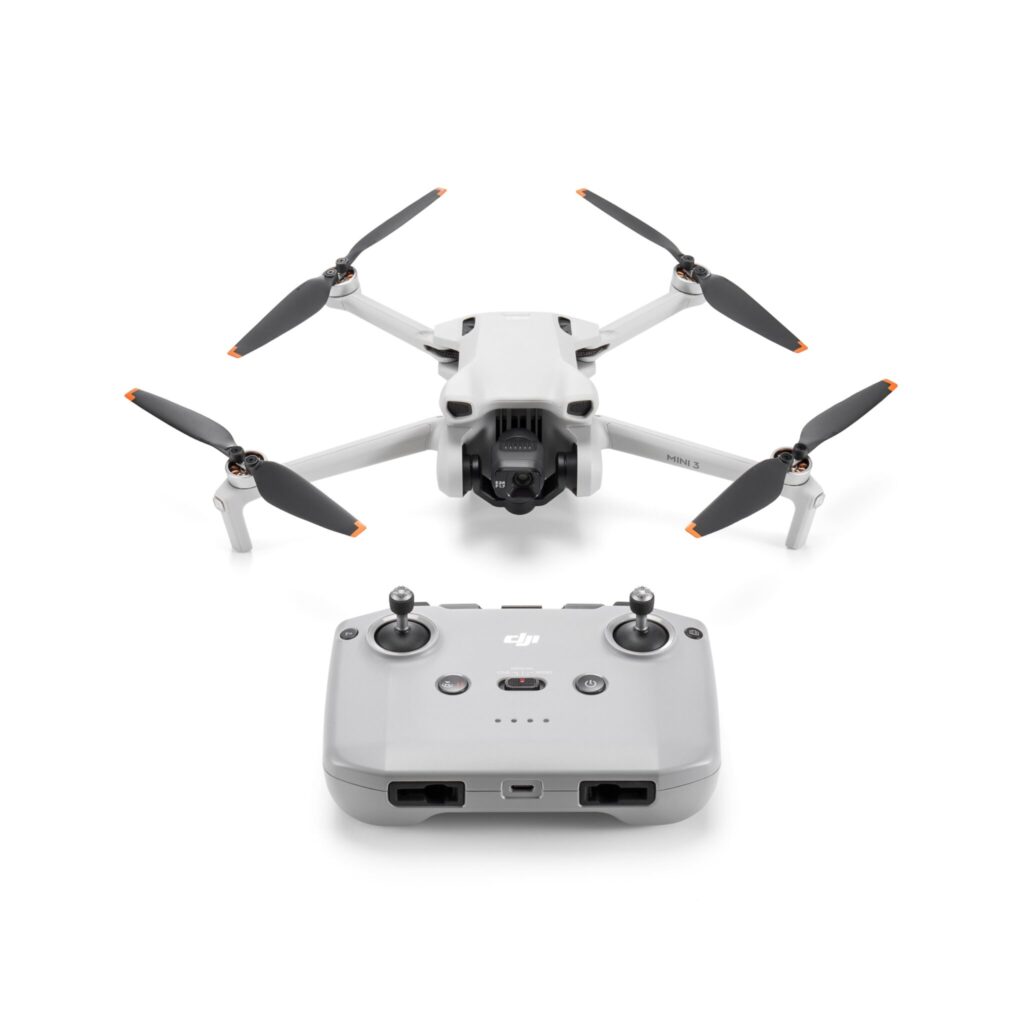
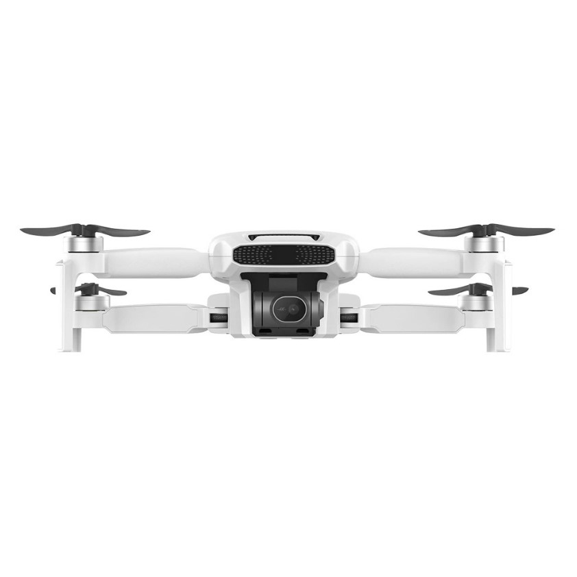
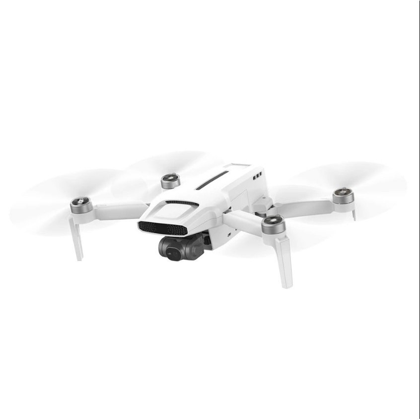
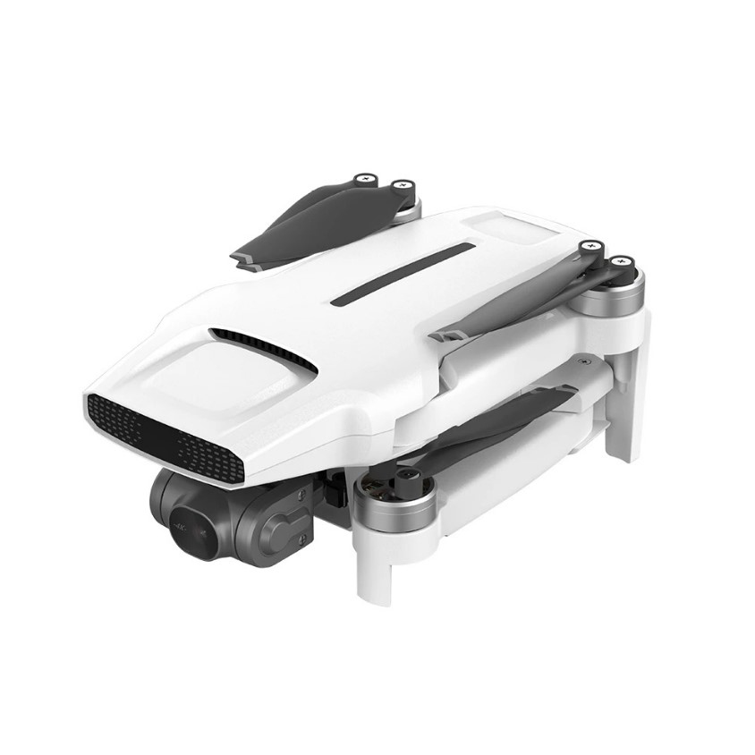
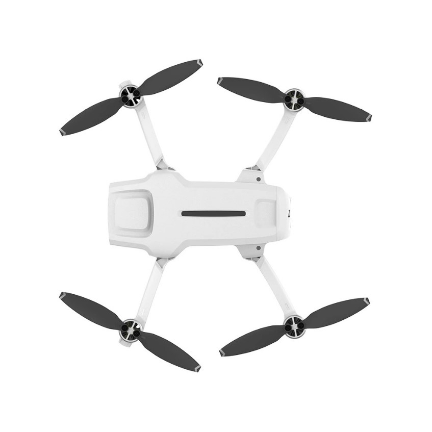
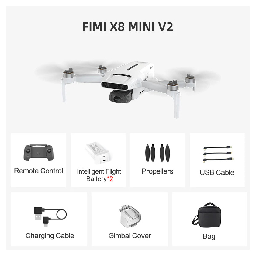
Droon FIMI X8 Mini V2 Combo (2x akut + 1x kott)
Початкова ціна була: 415,99 €.353,59 €Поточна ціна: 353,59 €.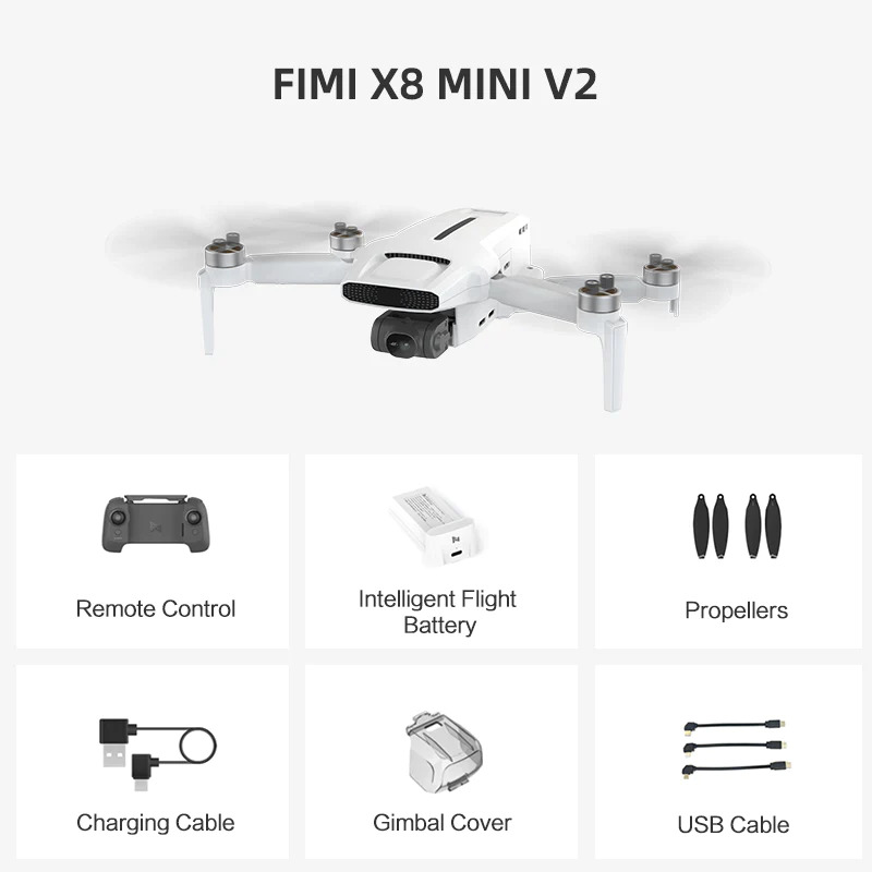
Комбо-навушники Droon FIMI X8 Mini V2
Початкова ціна була: 359,99 €.305,99 €Поточна ціна: 305,99 €.Нещодавно переглянуті


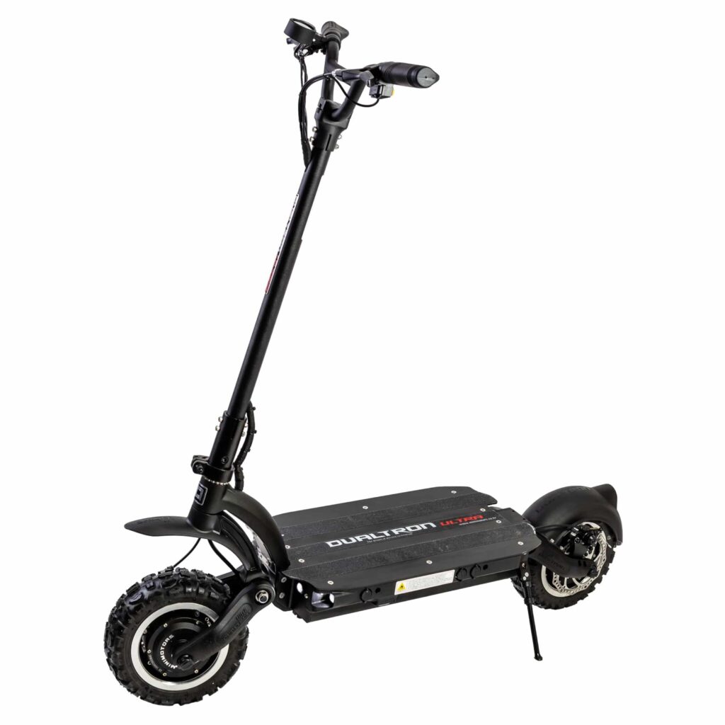
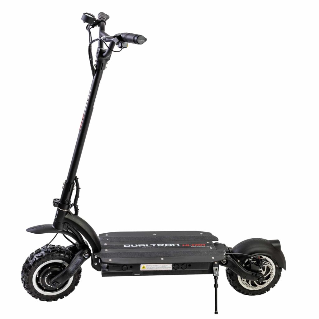
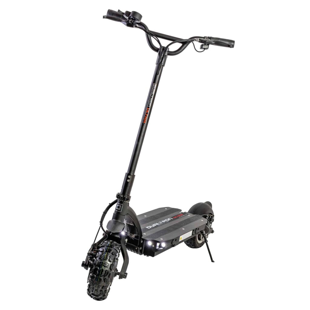
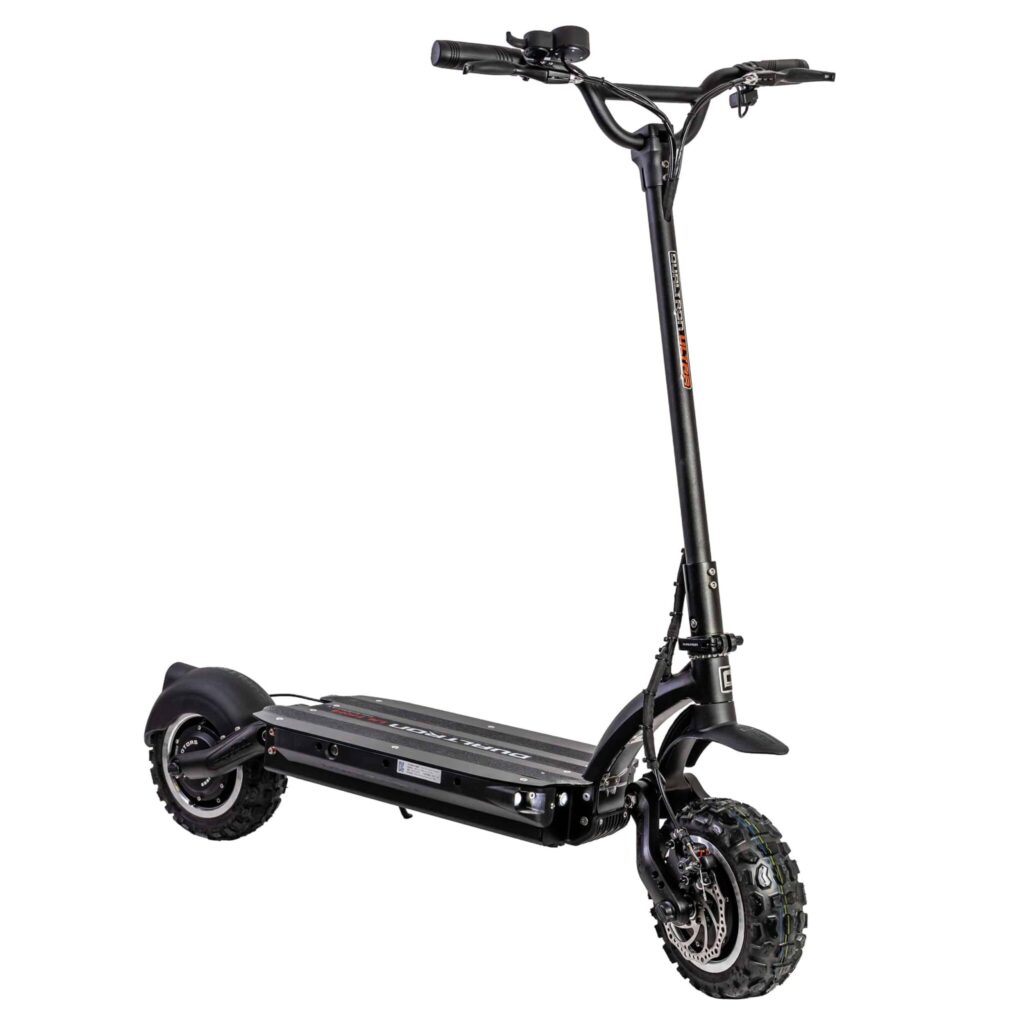
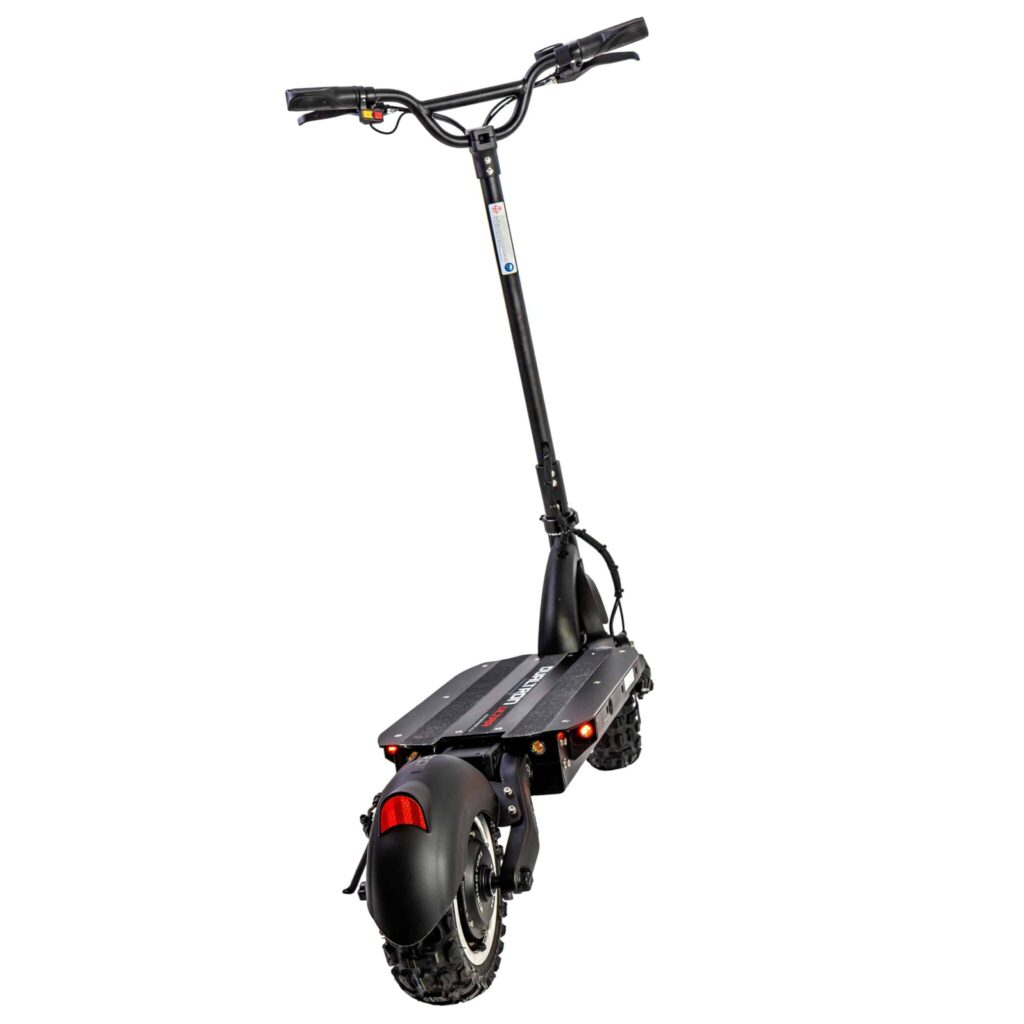
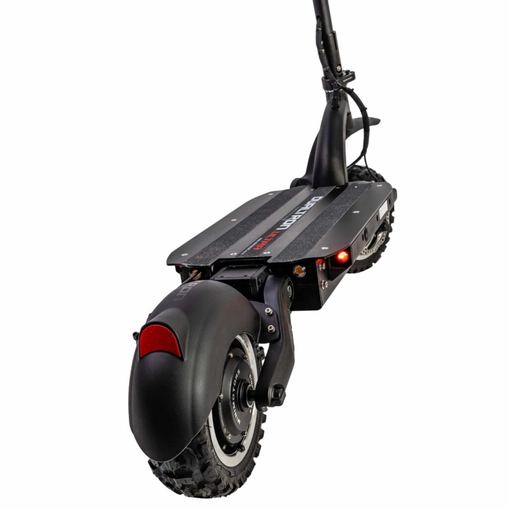

DUALTRON Ultra
Початкова ціна була: 2 999,99 €.2 799,99 €Поточна ціна: 2 799,99 €.