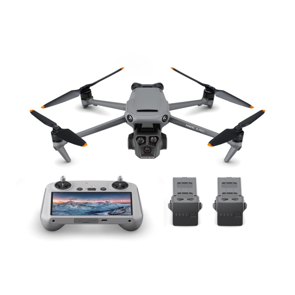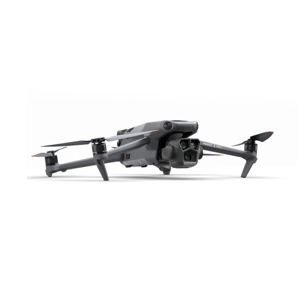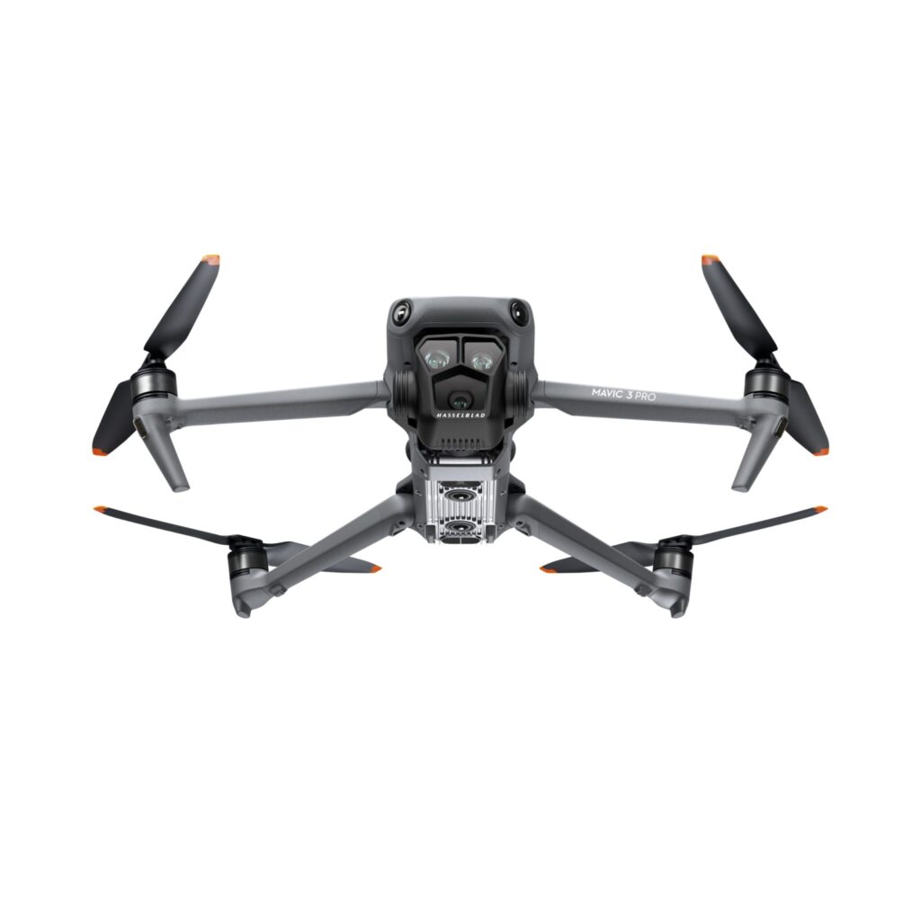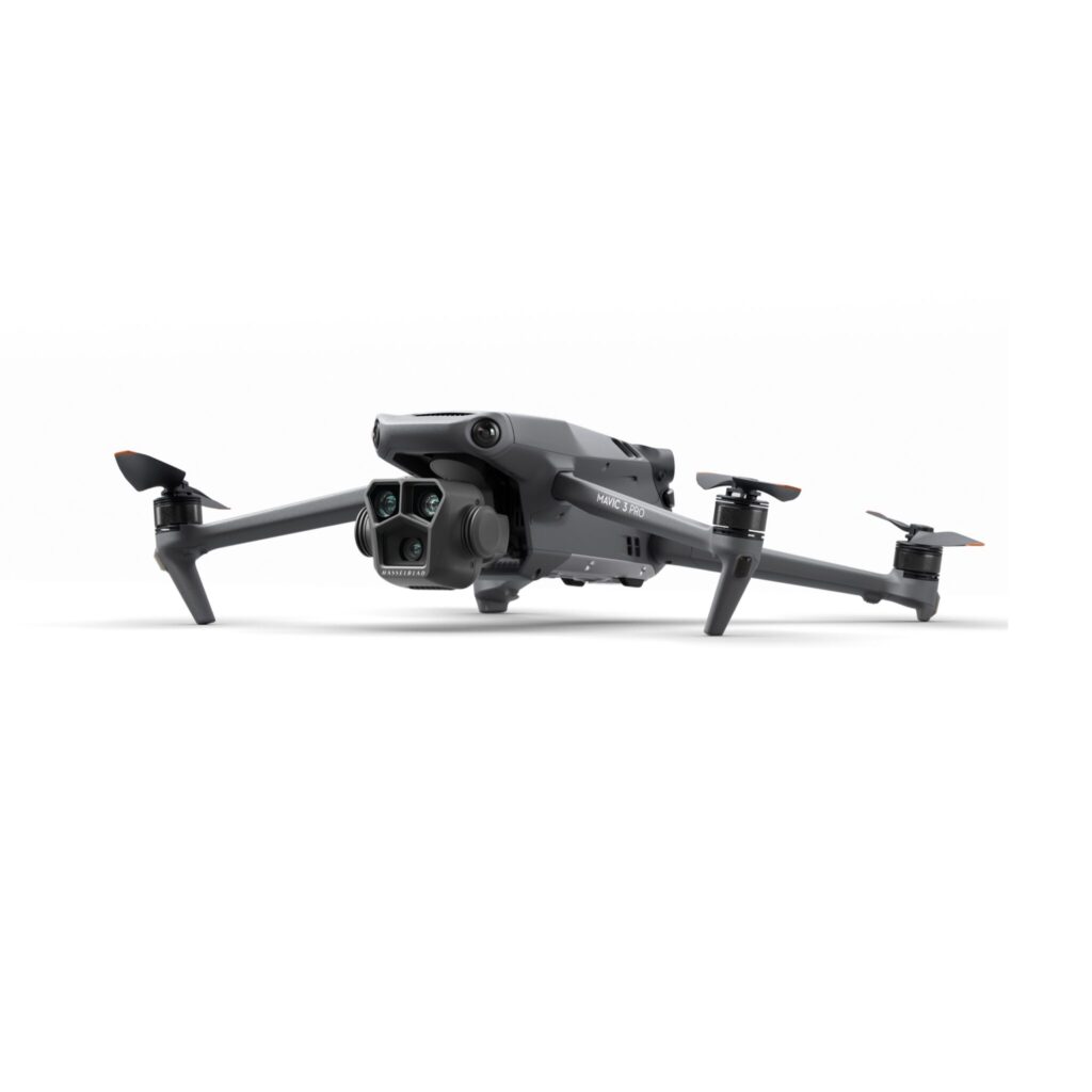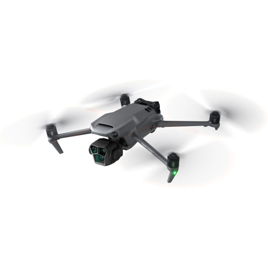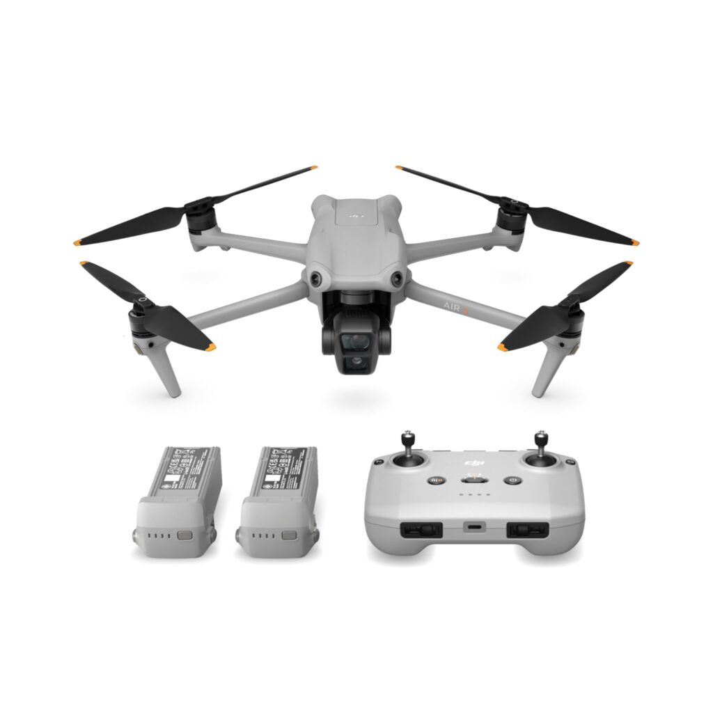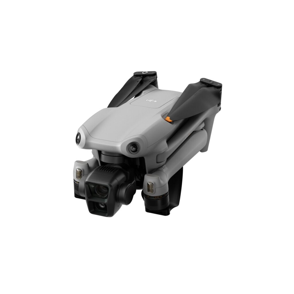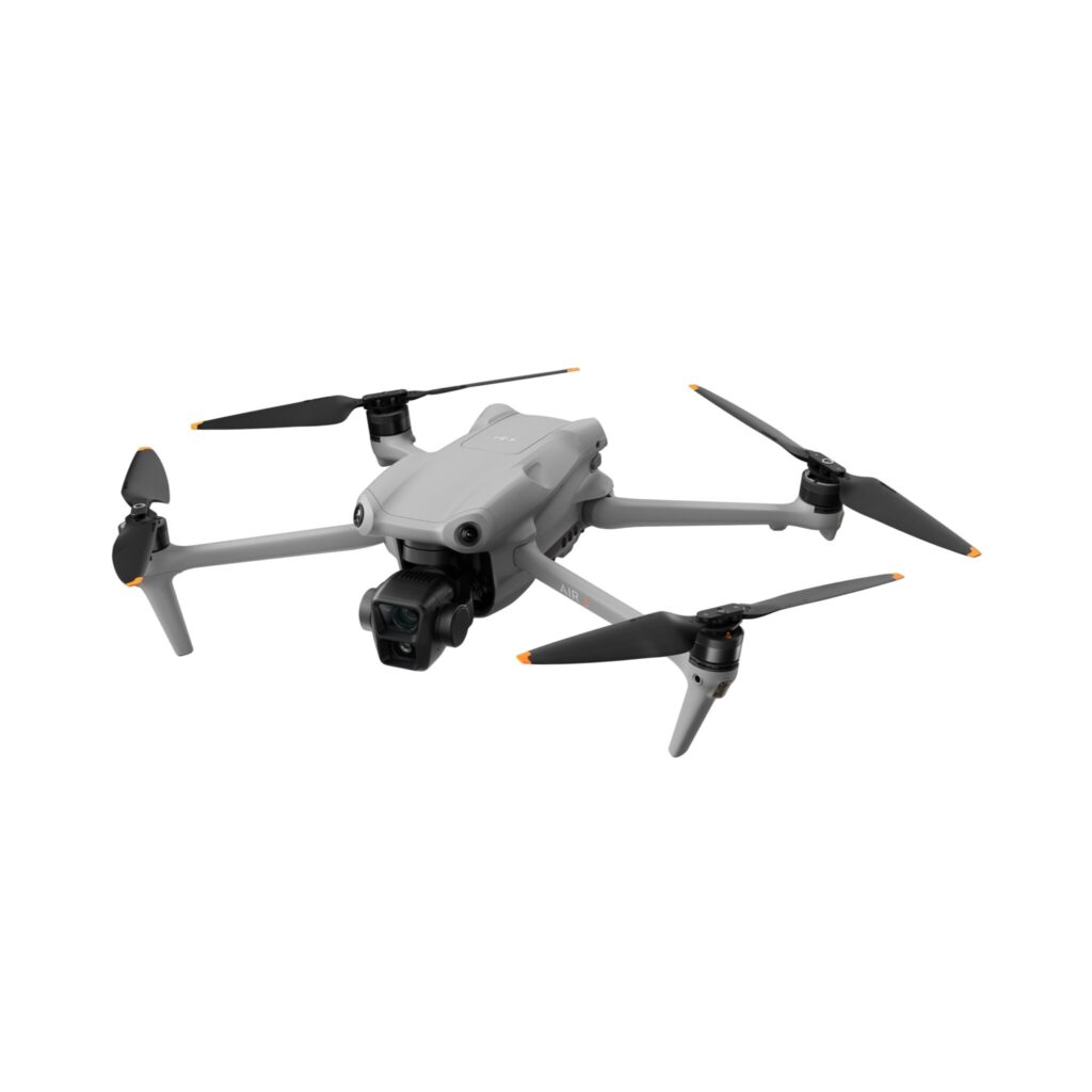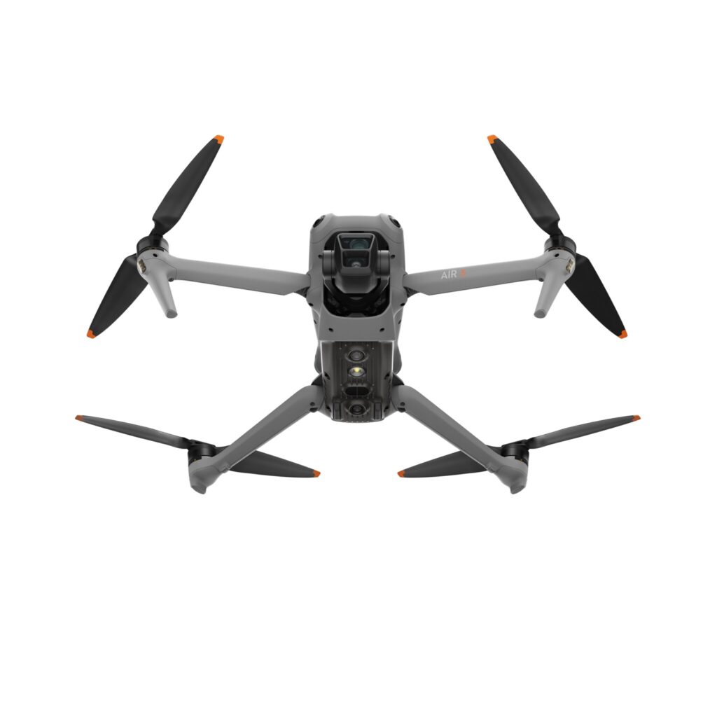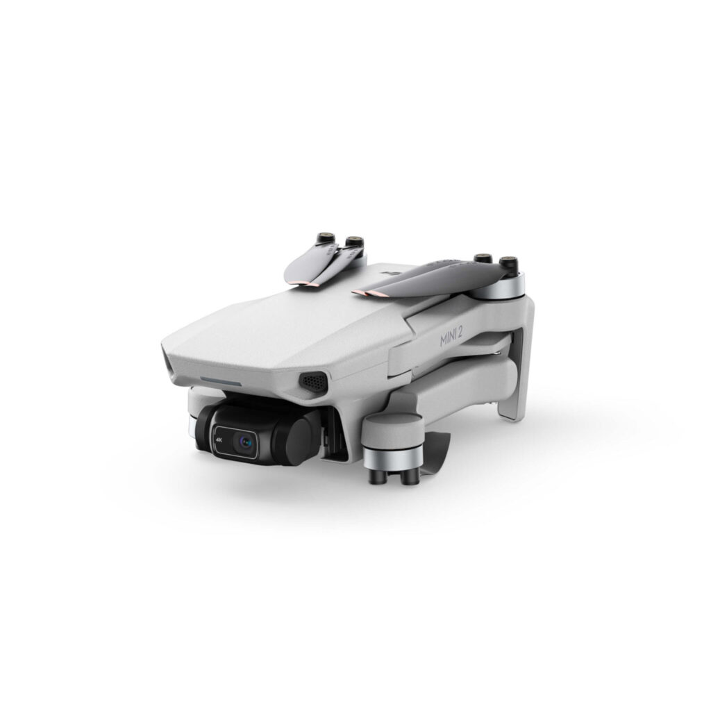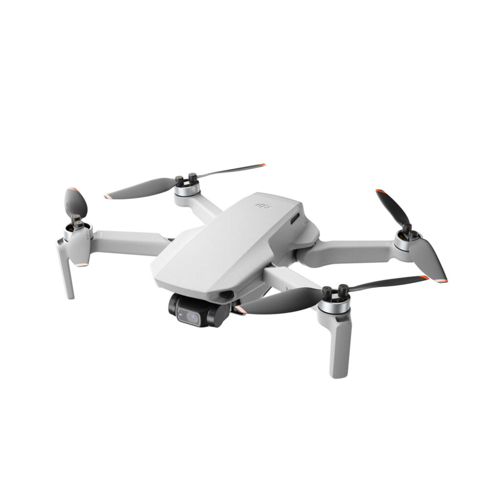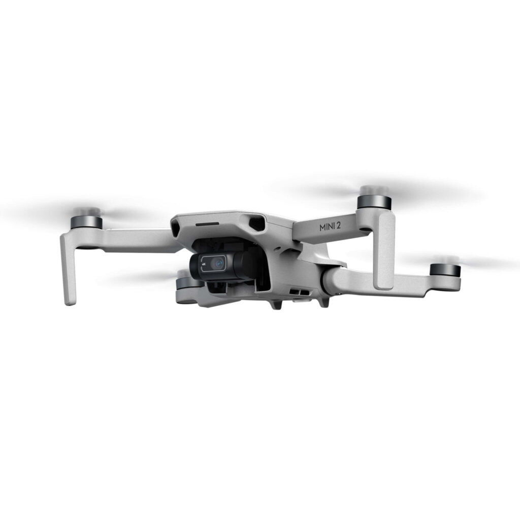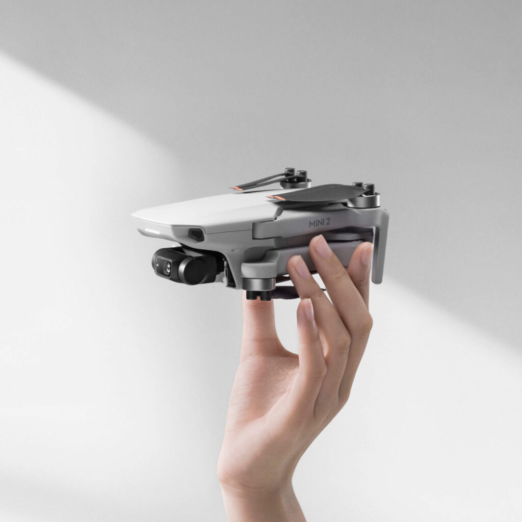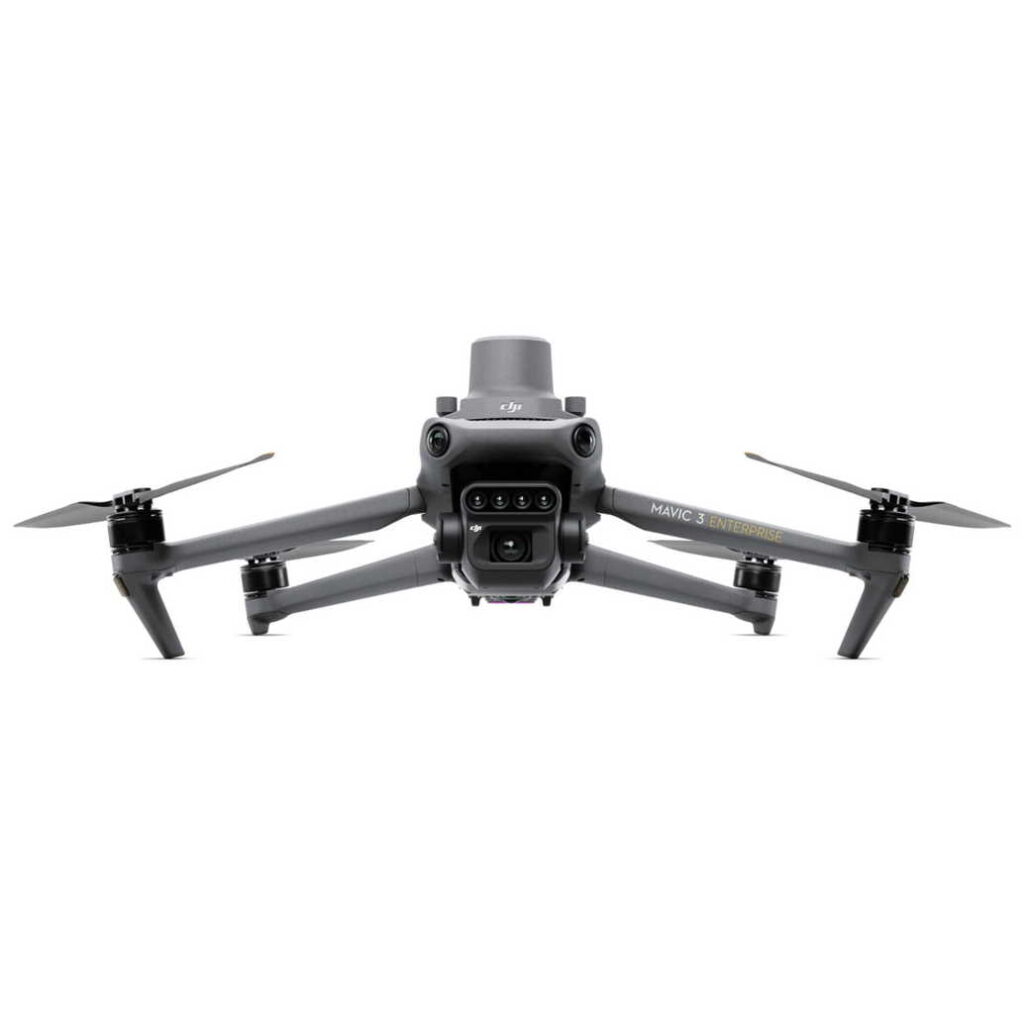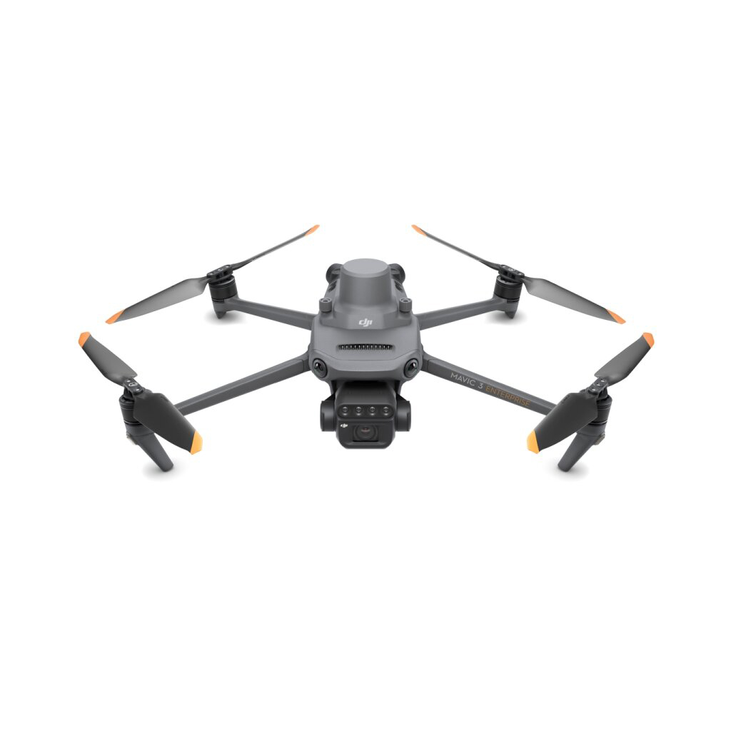

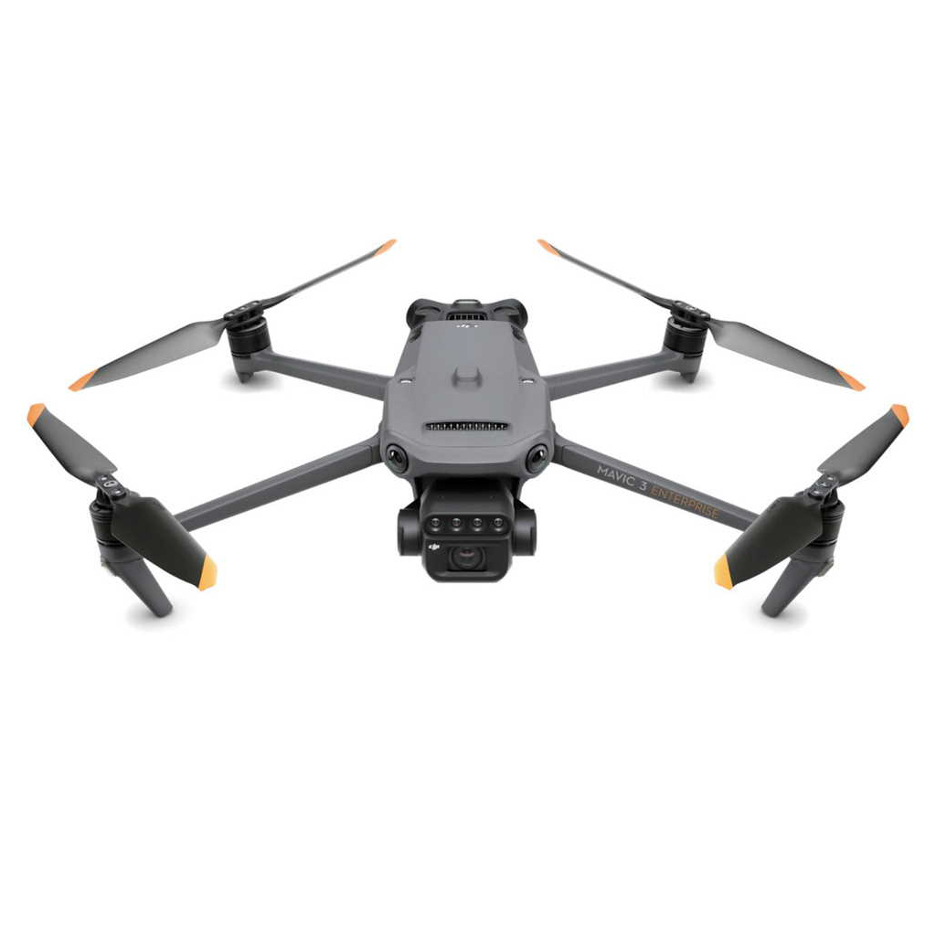

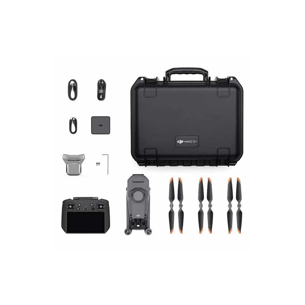
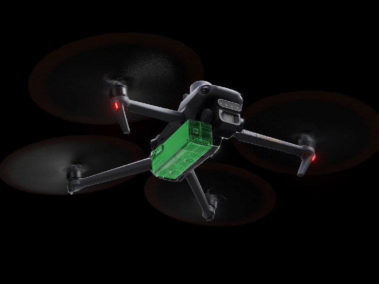
Drone DJI Mavic 3 Multispectral
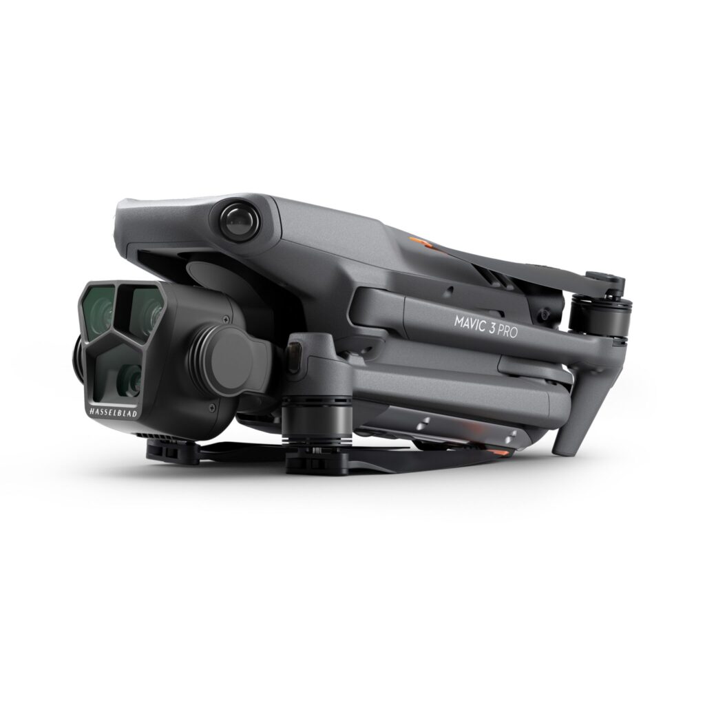
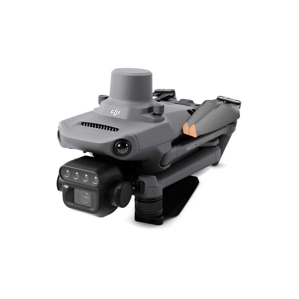
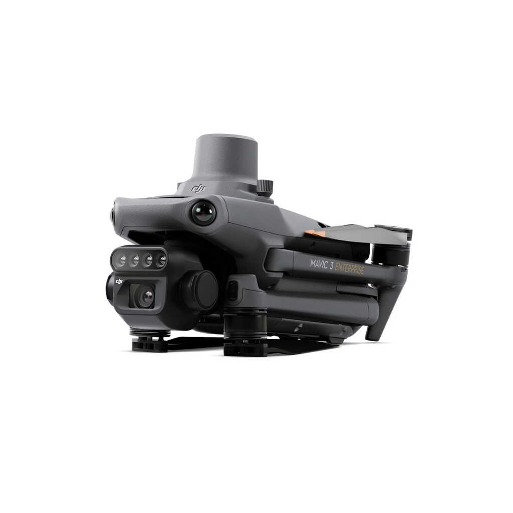
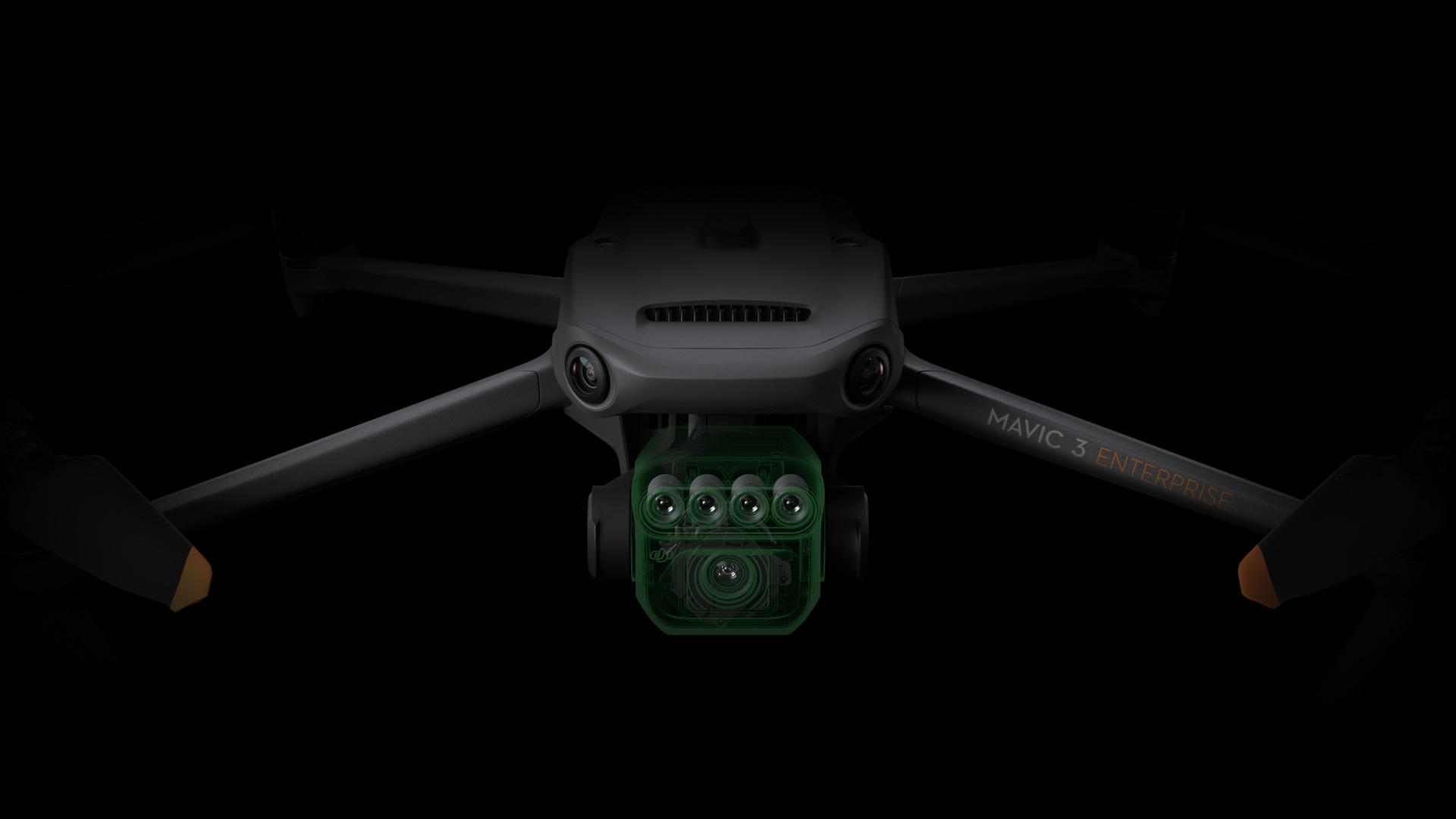
DJI Mavic 3 Multispectral (Mavic 3M) is a special version of the compact drone of the Mavic 3 series, equipped with a hybrid camera consisting of two modules. The visual module has a 4/3 CMOS matrix with a resolution of 20 megapixels. The second module is a 4 × 5 MP G/R/RE/NIR multispectral camera. To ensure high positioning accuracy, the aircraft is also equipped with an RTK module on the upper plane.
Compatible programs
- DJI Terra
- DJI SmartFarm
Description
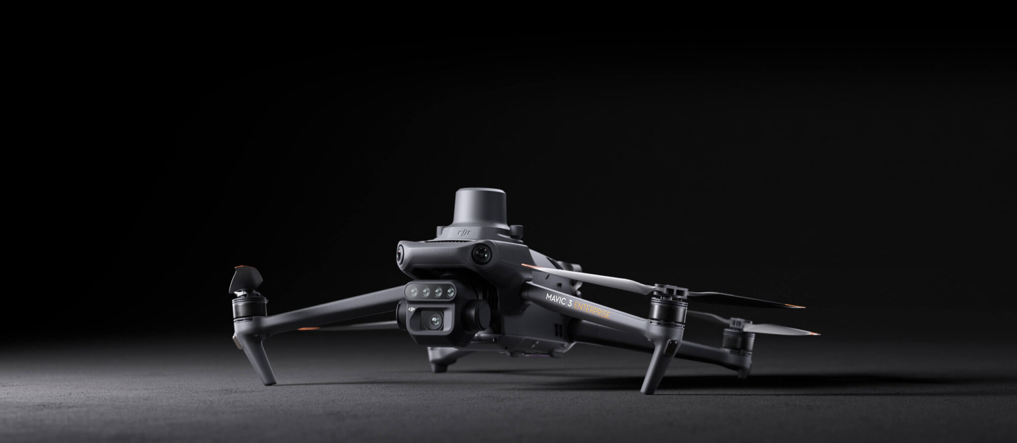
Effective aerial surveying needs to see the invisible. That’s why Mavic 3 Multispectral has two forms of sight. It combines an RGB camera with a multispectral camera to scan and analyze crop growth with total clarity. Agricultural production management requires precision and data, and Mavic 3M delivers both.
Highly integrated imaging system
The Mavic 3M Hybrid Camera is equipped with an integrated image processing system. It includes multispectral and RGB processing. Newly upgraded imaging system with one 20MP RGB camera and four 5MP multispectral cameras (green, red, red edge, and near infrared). Enables applications such as high-precision aerial surveying, crop growth monitoring, and natural resource surveys.


Additional information
| Net Weight (with propellers and RTK module) [1] | 951 g |
|---|---|
| Max Takeoff Weight | 1050 g |
| Dimensions (Folded/Unfolded) | Folded (without propellers): |
| Diagonal Length | 380.1 mm |
| Max Ascent Speed | 6 m/s (Normal Mode) |
| Max Descent Speed | 6 m/s (Normal Mode) |
| Max Speed (at sea level, no wind) [2] | 15 m/s (Normal Mode) |
| Max Wind Speed Resistance | 12 m/s [3] |
| Max Take-off Altitude Above Sea Level | 6000 m (without a payload) |
| Max Flight Time (without wind) | 43 minutes [4] |
| Max Hover Time (without wind) | 37 minutes [4] |
| Max Flight Distance | 32 km [6] |
| Max Tilt Angle | 30° (Normal Mode) |
| Max Angular Velocity | 200°/s |
| Hovering Accuracy Range | Vertical: |
| Internal Storage | N/A |
| Motor Model Number | 2008 |
| Propeller Model Number | 9453F Enterprise Edition |
| Light Sensor | Built-in module |
| ISO Range | 100–6400 |
| Supported File System | exFAT |
| Sensor | 1/2.8-inch CMOS, effective pixels: 5 MP |
| Lens | FOV: 73.91° (61.2° x 48.10°) |
| Multispectral Camera Band | Green (G): 560 ± 16 nm; |
| Gain Range | 1x-32x |
| Shutter Speed | Electronic Shutter: 1/30~1/12800 s |
| Max Image Size | 2592×1944 |
| Image Format | TIFF |
| Video Format | MP4 (MPEG-4 AVC/H.264) |
| Still Photography Mode | Single shot: 5 MP |
| Video Resolution | H.264 |
| Max Video Bitrate | Stream: 60 Mbps |
| Supported microSD Cards | Drone: |
| Recommended microSD Cards | Remote Controller: |
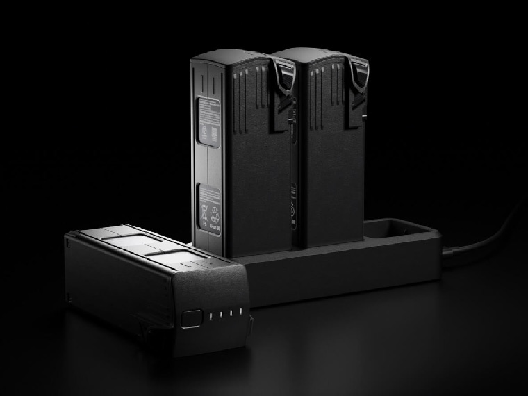
| Standard Voltage | 15.4 V |
| Max Charging Voltage | 17.6 V |
| Battery Type | Li-ion 4S |
| Chemical System | Lithium Cobalt |
| Capacity | 77 watt-hours |
| Output Power | 100 W |
| Input | USB-C: 5V to 20V, 5.0A |
| Output | Battery Port: 12V to 17.6V, 8.0A |
| Interface | USB-C |
| Power Input | Approximately 1.2 watts |
| RTK Positioning Accuracy | Fixed RTK: Horizontal: 1 cm + 1 ppm; Vertical: 1.5 cm + 1 ppm |
| Stabilized System | 3-axis mechanical gimbal (tilt, roll, pan) |
| Mechanical Range | Tilt: -135° to 45° |
| Controllable Range | Tilt: -90° to 35° |
| Max Control Speed (tilt) | 100°/s |
| Angular Vibration Range | ±0,007° |
| Sensing System Type | Omnidirectional binocular vision system, with an infrared sensor at the bottom of the aircraft |
| Forward | Distance Measuring Range: 0.5 m to 20 m |
| Backward | Distance Measuring Range: 0.5 m to 16 m |
| Lateral | Distance Measuring Range: 0.5 m to 25 m |
| Upward | Distance Measuring Range: 0.2 m to 10 m |
| Downward | Distance Measuring Range: 0.3 m to 18 m |
| Operating Environment | Front, Rear, Left, Right, Above: |
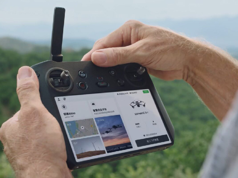
| Live View Quality | Remote Controller: 1080p/30fps |
| Operating Band [7] | 2,400–2,4835 GHz |
| Max Transmission Distance (Obstructed) [9] | Strong Interference (urban landscapes, residential areas, etc.): |
| Max Download Speed | 15 MB/s (with DJI RC Pro Industry Edition) |
| Latency (depending on environment and mobile device) | Approximately 200 milliseconds |
| Transmitter Power (EIRP) | 2,4 GHz: <33 dBm (FCC), <20 dBm (CE/SRRC/MIC) |
| Video Transmission System | DJI O3 Image Transmission Industry Edition |
| Max Effective Signal Distance (Unobstructed, No interference) [8] | FCC: 15 km |
| Operating Band of Image Transmission [7] | 2,400–2,4835 GHz |
| Antennas | 4 antennas, 2 transmitting and 4 receiving |
| Operating Band of Image Transmission and Transmitter Power (EIRP) | 2,4 GHz: < 33 dBm (FCC); <20 dBm (CE/SRRC/MIC) |
| Wi-Fi Protocol | 802,11 a/b/g/n/ac/ax |
| Wi-Fi Operating Band [7] | 2,400–2,4835 GHz |
| Wi-Fi Operating Band and Transmitter Power (EIRP) | 2,4 GHz: < 26 dBm (FCC); < 20 dBm (CE/SRRC/MIC) |
| Bluetooth Protocol | Bluetooth 5.1 |
| Bluetooth Operating Band | 2,400–2,4835 GHz |
| Bluetooth Transmitter Power (EIRP) | < 10 dBm |
| Screen Resolution | 1920×1080 |
| Screen Size | 5.5 inches |
| Screen Frame Rate | 60 fps |
| Screen Brightness | 1000 nits |
| Touch-Screen | 10-point multi-touch |
| Battery | Lithium-ion battery (5000 mAh, 7.2 V) |
| Charging Type | 100W Battery Charging Hub |
| Rated Power | 12 W |
| Storage Capacity | Internal Memory (ROM): 64 GB |
| Charging Time | Approx. 1,5 hours |
| Operating Time | Approx. 3 hours |
| Video Output Port | Mini-HDMI Port |
| Operating Temperature | -10° to 40°C (14° to 104° F) |
| Storage Temperature Range | < <1 month: -30° to 60° C (-22° to 140° F) |
| Charging Temperature | 5° to 40° C (41° to 104° F) |
| Supported DJI Aircraft [10] | DJI Mavic 3E |
| GNSS | GPS+GLONASS+GALILEO |
| Dimensions | Antenna is folded and no control sticks are installed: |
| Weight | Approx. 680 g |
| Model Number | RM510B |
| Footnotes | 1. Standard weight of the aircraft (including battery, propellers, and microSD card). Actual product weight may vary due to differences in batch materials and external factors. Use for reference only. |
Related products